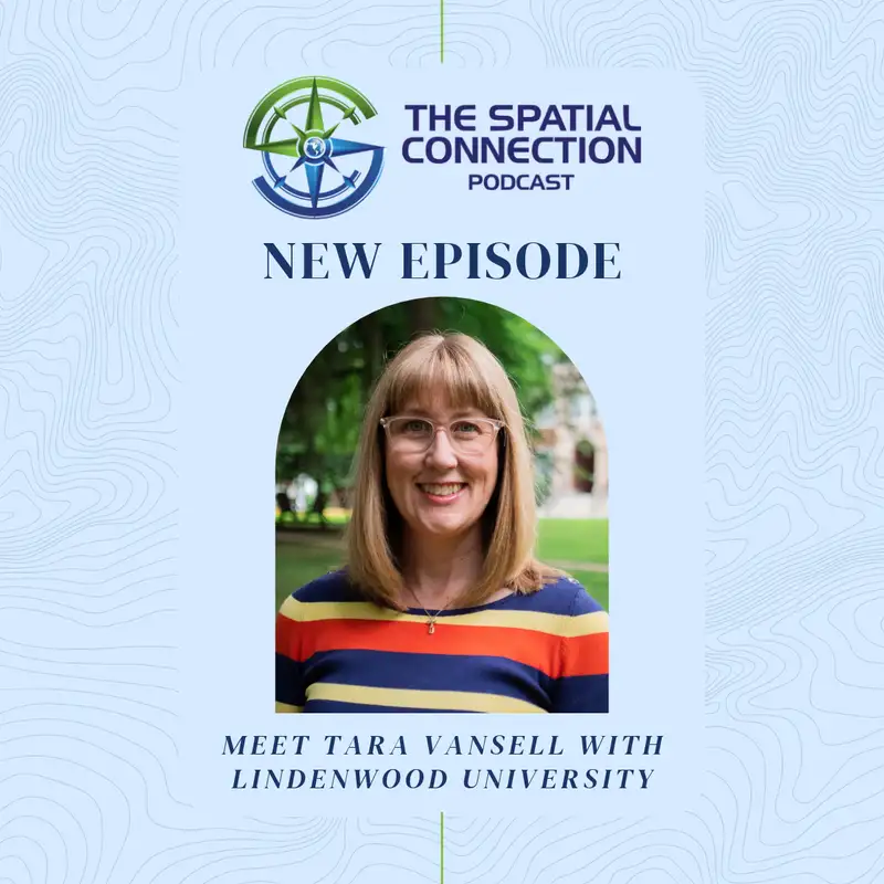
Tara Vansell
SCP_011_Tara Vansell_Audio only
===
Kelly: [00:00:00] Welcome back to The Spatial Connection, the podcast where we explore the fascinating journeys of geospatial professionals and dive into the incredible ways location-based technologies are shaping our world. I'm your host, Kelly McGee, and today's guest is Tara Vansell, senior GIS instructor at Lindenwood University.
In a GIS journey that started with the video game and TV game show Carmen Sandiego, Tara tells us about her path that led her to Lindenwood University and how she's helped shape their growing GIS program. Join me now as I talk with Tara to learn about her fascinating journey.
All right. Welcome back everybody for another episode of The Spatial Connection. Today, we have Tara Vancil, GIS instructor at Lindenwood. Tara, thanks for being here. It's great to have you back because of the fact, I say back because of the fact it's been a while since I've had a chance to talk with you.
And, ~you know,~ getting ready for this podcast, I kinda thought about and I went back and looked back when it was that we [00:01:00] first met each other back at SAIC days. That's been a long time ago. Not to- ~Mm-hmm~ ... age either one of us here, but so I'm really glad you're willing to be here at the podcast, and I think it's gonna be a good discussion.
With that, what I'd like to do is let's talk about how you- How did you first get interested in geography, GIS? And let's learn a ~l-~ little bit about why you even got started down this road where you're at to, to become a GIS instructor.
Tara: ~Okay.~ So my love of geography actually probably started in my middle school years, because I am part of the original Where in the World is Carmen Sandiego-
generation. So I remember coming home from school, making my bag of popcorn, and then sitting down in front of the television, this is early '90s, right? Um, and National Geographic had on PBS the original game show version- ... of Where in the World is Carmen Sandiego, and I loved it. I loved it that we were [00:02:00] chasing...
I mean, she was a criminal. We were chasing this criminal around the world to get these artifacts back. You were using, you know, some kind of trivia, spatial knowledge to answer the questions and the clues. And, um, you got amazing prizes, like an atlas- ... or a translator.
Kelly: Oh, wow.
Tara: You know, I loved watching that game.
I actually had a little job when I was 12 years old. I was in a play, and I... Anyway, I remember with my first paycheck I bought the computer game of Carmen. Oh, wow. Yes. Loved playing the game, and a- and still introduce the game to my students in the classroom today at Lindenwood. That is the midterm break.
Kelly: Interesting.
Tara: Is that we go back and look at that. It was also a very interesting time to have that television show and to be getting interested in geography, because the borders of the world were changing so [00:03:00] rapidly at that time.
Kelly: They're not set as much f- as-
Tara: They're not- ... much as people think ... set as much as people think.
And that was during the fall of the USSR, and the fall of the Berlin Wall. Fun fact about that show, they never played the first season again in reruns because all the borders changed- Interesting ... after that first season. And you will note in later seasons there is a disclaimer on all of it that says, "Facts were correct at time of filming."
Interesting. That's how quickly the borders of- ~Huh~ ... the world was changing at that time. Yeah.
Kelly: Wow.
Tara: So I would say that was my first bug, was that ~I,~ I really loved that show. And then I always loved social studies, history, geography, civics that were taught in high school and everything. But I will say that in high school- I also really love music, and going into college, I had decided that I was going to be a music education [00:04:00] major.
Kelly: Okay.
Tara: That ~that~ was what I wanted to do. And I really focused a lot of my high school years on music because I had that, ~that~ goal, that thing in my head. And if I could go back to that era of my life, I wish that I had taken the time to maybe do some different experiences- ... and to do some exploration then.
Kelly: As far as, like, topics?
Tara: As far as topics, as far as learning what other careers might be out there. And I think that's something, that's why I love that you're doing this podcast, is I think that's something that we're still not great about doing with our kids and our high school students. I think we still ask that question, "What do you wanna be when you grow up?"
Kelly: And they don't know what the options are.
Tara: How... Right. The, [00:05:00] I mean, their, their options are still the same. It's what they've seen. They know what their parents do, hopefully. They see their teachers, they see doctors, they see nurses, they see firefighters, they see, ~um,~ law enforcement officers. ~Mm-hmm.~ You know, they see people that work at the grocery store and the library, and they don't know everything else that's- ~Right~
out there. And I think we would be better if we start off starting to ask the question, "What problems do you like to solve?" Or, "What, what topics- Mm-hmm ... in school interest you, and why?" And, "Do you see how that is actually connected to this other subject?"
Kelly: Rather than starting with a career-
Tara: Yes ...
Kelly: start with the interest.
Tara: Yeah. What is the interest? And then, and then maybe we can give them more of a menu of, well, these interests could lar- lead to all these different things.
Kelly: And I think that's important because a lot of [00:06:00] times the interest, they don't realize- What jobs would require that skill set?
Tara: There are really great programs now in a lot of our regional high schools where you can study, like, career and professional studies.
My daughter did that in high school, where half the day she did her traditional classes on their high school campus, and then the other half of the day she spent in this career-oriented format- Huh ... where they actually went to different businesses in the region and talked about what they did, and if they were an entrepreneur, ~you know,~ how did they get started and what skills did they have, what do they wish they had studied more, you know, if they could- ~Yeah~
go back. And that was a hugely valuable experience for her because it helped her see what she didn't wanna do, and she got to test it out before we-~ Mm-hmm ... ~went to college and we were paying for it. Right. ~Right?~ It verified or validated [00:07:00] the skills and the interests that she really did have, and she saw how she could apply them-
Kelly: And
Tara: that's-
in the future ...
Kelly: like you said,
Tara: very
Kelly: valuable in
Tara: itself. Right. So, ~so~ I guess I, I bring up my music education more just to showcase that broader point- Yeah ... to students and to parents to don't feel like you have to make that decision- ... your sophomore year-
Kelly: Right ...
Tara: when you start taking the ACT ~and,~ and you start thinking about colleges, but to have as many different experiences as possible, what you learn from those experiences, to apply that- Yes
to your university search.
Kelly: I think that would also help in learning how to use the other courses that you're taking anyway to see that they have value, even if that's not your primary focus. Yes. You know, math, English, all those, ~uh,~ different types of- Mm-hmm ... classes.
Tara: And so often we... you know, students will ask, "Well, when am I [00:08:00] ever gonna use this again?"
Right?
Kelly: I ask that many times.
Tara: Sometimes it's not about whether or not you're gonna use that exact thing again.
Kelly: Yes.
Tara: The reason you learn that is to train that part of your brain to think in that analytical kinda way. Because math trains your brain to do different things, music trains your brain, geography- ~Mm-hmm~
has its own section, English has its own section. So if you think about your courses instead of, "When am I gonna use this again?" But you think of it more as a workout.
Kelly: ~Mm-hmm. ~
Tara: Like, okay, this is leg day, and this is- ... cardio, and this is... You need all of those to stay healthy, and your brain needs all those different connections and ways of thinking in order to make you-
Kelly: They give you a good
Tara: tool set
~a, a, ~a, right, a stronger tool set-
Kelly: Yes ...
Tara: later Okay, so all of that, I started my undergraduate career in music education. Found out very quickly that was supposed to stay a hobby.
Kelly: And where was this at?
Tara: [00:09:00] This was at the University of Missouri in Columbia. Okay. So MIZ- ... ZOU. Yes, found out, met wonderful people doing Marching Mizzou there, you know, all the things.
Had that music community, but realized that wasn't gonna be the long-term thing after all. I still did wanna teach. ~I s-~ I still felt like I was called to be in the classroom. So thinking what were the, what was my next favorite thing that I always have done all this time, I went back to social studies and decided I wanted to do the, ~uh,~ middle school, high school social studies educator.
Kelly: Okay. I think social studies is one of those where you don't usually have a geography class or anything near that. That's probably the closest that I think a lot of students are exposed to.
Tara: You usually have, at least in the state of Missouri, you usually have geography your freshman year.
Kelly: Hmm.
Tara: And then the rest of social studies is history, world history, American history, civics-
Kelly: Okay
Tara: political science kind of [00:10:00] stuff. So when I transitioned to do s- be a social studies educator, those were all the classes then that I started to be put into. So I did my history. I did geography, and that's where the light bulb went off that I remembered my days back with good old Carmen Sandiego. I loved the way it was organized.
Like, again, kind of thinking back to how those subjects train different parts of your brain. History can be kind of linear. I mean, you follow... Their tool is- Is a timeline, yeah ... the timeline, right? And I can memorize facts and keep them in order, and that's fine. ~I,~ I didn't have the vocabulary then to say- ~Mm-hmm~
physical geography of the place. I was like, "What about the landscape? What about the weather that happened during that event?"
Kelly: Right. "
Tara: What about who was in power during that situation? What about..." So I was naturally thinking like a geographer, [00:11:00] but I didn't- All these
Kelly: different variables ...
Tara: all these different variables- Okay
that are important to the narrative.
Kelly: Yes.
Tara: But like I said, I didn't have the vocabulary for it yet. But when I started taking the geography courses, that vocabulary started to develop. And then in taking the geography courses, I also learned about, they talked about this thing called GIS, and I said, "Well, what's that?"
"It's Geographic Information System. You're putting these variables together in a computer system so that you can answer those questions that you have, Tara." Mm-hmm. And I was like, "Oh, something that..." I also love to organize things. I don't know, have you ever asked that question on this podcast, do you like to organize?
Kelly: No, I have not.
Tara: I'm not a decorator, but I like to organize things. Yeah. I like to have things in their little buckets. And I was like, "Oh, a system that will let me organize all these thoughts into- I never thought of that way ... into a manageable [00:12:00] container. This is very appealing to me ~Um,~ and then they said, "Oh, and there's a geographic resources center in the basement that hires students."
"And you get paid above minimum wage to work on these research projects." Hmm. And I thought, "Well, I'm gonna, I'm gonna check that out." ~I, you know,~ I was working at the time at Mail Boxes Etc. I learned a lot at that job too. Mainly how to fix a copy machine. I went to the geographic resources center and applied with, ~you know,~ the knowledge that I had.
I said, "I love geography. This sounds really interesting to me. I'm willing to learn. I heard that you're hiring." And that was enough-
Yeah ...
at the time, was ~the, the willingness and the,~ the willingness to be trained. ~Um-~
Kelly: That is a big skill set and it's self.
Tara: Yes. The availability and the eagerness to learn.
And so once I started working there, I decided, [00:13:00] "Well, I'm switching my major to geography." So-
Kelly: So-
Tara: Instead of going into education at that time, I actually completely switched- Okay ... my major to geography.
Kelly: And what year in school was this? This
Tara: is like sophomore? Uh, this was going into my junior year.
Kelly: Oh, wow.
Tara: Okay. So I had done two years of education coursework, which I'm very thankful for- Yeah ... because I've been able to carry that into my career later, and other colleagues don't necessarily have that education foundation. They have the, obviously the- The technical side, yeah ... the technical, the subject matter expertise, but I do have some classroom management and, ~um-~
Kelly: Which
Tara: is
Kelly: good.
Tara: Right. Yeah. And, ~and, and~ thinking about how you design classes and support students.
Kelly: Yeah. Sometimes the, uh, most technical people are not the ones you want teaching the class.
Tara: Sure.
Kelly: It's gonna be a long class.
Tara: Sure. ~Sure.~ So I'm very thankful that I, ~I~ had those two [00:14:00] years with the education department, but I'm very glad that I switched completely- Yeah
to the, to my geography major. And then at the time, you picked, like, a track- Mm-hmm ... that you specialized in. You would be a geography major, and then you would do the urban geography track.
Kelly: Okay. Yeah.
Tara: But I, we had the GIS tract at that time.
Kelly: Oh, awesome.
Tara: So I am from a early era, I would say, of, ~uh-~
Kelly: Of a GIS-focused-
Tara: Yeah
Kelly: geography.
Tara: ~Um,~ and especially for an undergraduate.
Kelly: Yeah.
Tara: Because there were graduate programs at that... Right. I mean, Penn State was already around then. Yes. To have an
Kelly: undergraduate- It was still new in a lot of-
Tara: Yes ...
Kelly: undergraduate, yes.
Tara: So I feel very fortunate that I had that ability to have the geography major, the GIS emphasis, and that I had two years working in the Geographic Resources Center with amazing mentors.
You're asking about, ~you know,~ the origin story and when I was bit by the spider- ... kind of thing. They made sure that I got to present my [00:15:00] work as an undergraduate at- Oh, wow ... the Esri User Conference. So the summer between my junior and senior year, I got to go to San Diego. It's the first time I'd ever flown on a plane.
Off on my own for the first time without family. All that kind of very adulting stuff. Yes. Right? Get to San Diego. I know the conference is a big deal, but I don't know the conference is a big deal.
Kelly: So from Carmen, Sandiego to-
Tara: Yes ... To the Esri UC. ~Um,~ and I remember walking in to the plenary, and there, ~you know,~ there's 10,000- Thousands and thousands
10,000 to 20,000 other geographers there that have all played Carmen. And ~I was,~ I was like, "Wow, this is more than just my degree. This is more than just my little job in the Geographic- Right ... Resources Center and what's next. This is a whole community."
Kelly: A large community.
Tara: A large community and a movement [00:16:00] that I can be a part of at a, I think, a really special time.
Kelly: Yes. That was the Esri User Conference is one of those where you get a chance to not even talk about the software so much. It's about seeing all the different people, all the different applications of GIS, and you get a wide variety there.
Tara: Right, because you see all the industries-
Kelly: Yes ...
Tara: that use the tools.
So while I was getting to present to kind of an academic and historical kind of audience. Because I had digitized the Missouri 1980 census from Mylar.
Kelly: Mylar.
~Um,~
Tara: and it was so exciting that we had this census data from the 1980s now to add to our collection of data, right?
Kelly: Yes, 'cause back-
Tara: ~Um,~ but, ~no,~ no, it was
in the early stages, it was getting that data It was. It was. It was getting that data. But I also got to see how it was used in urban planning, and how it was used in utilities, and how it [00:17:00] was used in government and conservation. Mm-hmm. And I realized that there were all these people out there that were using this tool to organize-
Kelly: Yes
Tara: their thoughts and careers the way I had learned to, to use it, and that there were so many different directions that I could go.
Kelly: That's what I find fascinating about GIS, is it's not just an industry in itself. It's part of so many other industries.
Tara: Yes.
Kelly: It's-
Tara: Geospatial in everything.
Kelly: Yes.
Tara: Absolutely. So that's when I was really bit by the bug, and then got engaged-
as you do towards the end of, ~uh-~
Kelly: College
Tara: life ...
Kelly: your
Tara: college life. My husband got a job here in the St. Louis region, so then I was able to focus my job search also to the region, and found myself at Surdex-
Kelly: Yep ...
Tara: which is another absolutely amazing community.
Kelly: It is.
Tara: Small, family-run [00:18:00] business at the time- Yeah
but with big projects.
Kelly: Big projects. Well-known.
Tara: Well-known. Really solid work, just really good work. They wanted to put out good quality products, take care of their customers, and I learned so much there. I learned so much more about GIS there, but again, I learned so much about how the data was being used.
I was gonna say,
Kelly: even though their focus isn't GIS, it was the photogrammetry side, it was all being used mainly, I shouldn't say all, but mainly a lot of it was being used for GIS.
Tara: Yes.
Kelly: Yeah.
Tara: Yeah. And, ~and~ the different government agencies that were using it, and the different scales. So whether it was a city- You really learn about
Kelly: scale
Tara: there.
Right. If it was a city- Yes ... and what was, what were the important assets for them to collect, or if it was a county, or how was the city trying to share that contract with the county for them to get the most bang for their buck. But, that's all really [00:19:00] important when you're- It is ... thinking about designing a project later for a client.
Kelly: Having that opportunity is also very- fortuitous because of the fact that you learn that imagery in itself is not just imagery. There's a lot that goes into it. It's not just going out and snapping a picture. ~Mm-hmm.~ There's a lot of work that goes in there to get that data and be, ~you know,~ create your, ~uh,~ orthophotography to make it usable, to make it so that you can actually measure.
There's a lot goes into it, and it's pretty unique to see how that's done. So, yes.
Tara: Right.
Kelly: And
Tara: the,
Kelly: from the- I spent my time there as
Tara: well ... from the flight planning-
Kelly: Yes ...
Tara: I mean, using GIS just to manage the projects, like the flight planning to the collection of the photography to the orthorectification. It's kind of cyclical there.
Yes. They're
Kelly: using the tool to create data- Yes ... that's gonna support the tool.
Tara: Yes.
Kelly: Yes.
Tara: To the, the collection to the, and the GIS department was really the quality control, so we were kind of the last step before it went to the client. Um, so making sure that all those attribute tables were [00:20:00] clean, and the geometry looked right, and it was a wonderful ex- you know, learning how to automate things- Yeah
for the first time. I was also at that, that, that time in my career, not to get too technical, that was really the- transition point between command line- Oh, okay ... and then all the toolbars- Yes ... and the, so that- Typing
Kelly: out your command- So- ... versus clicking on
Tara: something Right. So that was, if I could go back to my undergraduate now, because I learned command line first, I wish I had done more computer science because I was so close and I didn't, I was doing it- ~Mm-hmm~
and I didn't realize I was
Kelly: doing it. There's a lot that you, I think as you're going through your educational career, goes back to what you were saying earlier, you don't understand how you're gonna apply that class- ~Mm-hmm~ ... or whatever. ~Mm-hmm.~ And even if you're taking that class and it doesn't make sense to you, it's because you, ~you~ may not know where else it is gonna be used.
I did that in [00:21:00] linear algebra. ~Mm-hmm.~ I did linear algebra and I'm like, "Oh, there's more matrices in here than I ever care to think about. I don't really understand where I'm gonna use it." ~Mm-hmm.~ And then later when I switched over to geography and started doing re- you know, remote sensing, then it clicked.
You know, the light bulb clicked there. So yeah, it's-
Tara: I've had students have that same light bulb click when we're using the drones. You talked about algebra, to like program the slope formula- Okay ... to get it to fly, you know, at a diagonal. Mm-hmm. And they're like, "If I ~had~ had the, if I could have seen the formula fly the drone then, I would have ~understand,~ understood the value of it-
Kelly: Yes
more then." It wasn't
Tara: just about
Kelly: doing formulas.
Tara: Right. It wasn't just a formula, it was if it had that purpose that you were programming the drone so that it would be able to inspect this building at this height- Yeah ... and this is how you wanted it to do that flight path-
Kelly: I think it's hard to- ...
Tara: it
Kelly: could have
to try to take all those potential use cases-
Tara: Sure ...
Kelly: and design courses around that, and [00:22:00] design an entire educational-
Tara: Sure ...
Kelly: program. So ~I,~ I get that it's hard to do that.
Tara: Sure.
Kelly: ~Uh,~
Tara: that's- And there are technologies we have today that we didn't have- Yes ... then. It's a fun, and that's a fun puzzle-
Kelly: It is ...
Tara: as well, ~as well.~
Kelly: And that's where it's, I think we have to try to help students understand that~ you gotta think about,~ you have to think back to when you were using another course. You know, where can you apply that? How can you apply that?
Tara: Mm-hmm.
Kelly: So now you're at Surdex now. Yeah, so
Tara: I was Surdex. I realized that Surdex was a lot of map production-
Kelly: Yes
Tara: And I, ~and,~ and then also learning about clients ~and,~ and sort of the business, some of the business model stuff behind that.
I realized that if I ever wanted to get on the other side of the data and do the analysis, I was gonna need my master's degree.
Kelly: And that's quite common.
Tara: Yes. And, ~and~ it's also, I think, very common to this region, the St. Louis region, because we do have so many powerhouse institutions.
Kelly: In a very sm-
Tara: small- And a very...[00:23:00]
Yes. Yes. In a small radius. Yes. ~That~ that expertise is expected, ~and,~ and that's great- Mm-hmm ... for St. Louis, that we have this very highly educated workforce. Yes. Populous in that way.
Kelly: We have a lot of resources available.
Tara: Yes, absolutely. In choosing where I wanted to do my master's and what I was gonna do next, I was looking for GIS.
So I was looking for institutions in the region that I could find that they had Some Esri presence in their computer labs ~Oh~ ... or, ~um,~ that they were teaching some GIS courses. This is also before there was a lot of online master's degrees. We weren't moving-
Kelly: Mm-hmm ...
Tara: ~um,~ for me to do this degree, so I needed to stay in the region.
And I found that the urban planning and real estate development degree at St. Louis University-
Kelly: Okay ...
Tara: had, or that department had some [00:24:00] geography-
Kelly: Yes, SLU does- And GIS ... where they had multiple departments- Yes ... and multiple schools.
Tara: Yes.
Kelly: They would apply GIS.
Tara: So I, my intention was to stay at Surdex at the time and go to school part-time.
When the department found out that I had GIS skills, they quickly offered me a research assistantship, and then suddenly I was going to have everything paid for and a stipend.
Kelly: That's a good deal.
Tara: And that was a good deal. And so I ended up saying goodbye to Surdex at that point and transitioned to being a full-time research assistant when I was studying there- Nice
for
Kelly: that
Tara: program.
Kelly: Time to move to the next chapter, wasn't
Tara: it? Time to move to the next chapter. Yep. Good. Exactly.
Kelly: So now you're at SLU, and- I'm at
Tara: SLU ...
Kelly: now you're kinda starting to evolve a little bit here.
Tara: I'm s- I'm starting my urban planning program. St. Louis, and I didn't, ~you know,~ again, fortuitous, in the right place at the right [00:25:00] time.
I did not realize how fascinating St. Louis was going to be to study- ~Hmm~ ... for urban planning and urban geography. I'm a Midwest girl. I've grown up in the Midwest. My childhood was actually north of here in the Quad Cities. Okay. Moline, Illinois, down in Port Iowa, which I think there could be really interesting parallel studies between the cities and- Yeah
St. Louis and because you have the same river boundary and... I digress. ~Um-~
Kelly: It's a geography thing ...
Tara: it's a geography thing. ~You,~ you wander and then you come back. Yeah. So I'm studying urban planning. I'm learning about the city. It's also, at that time in St. Louis, that's when, like, the big loft boom is happening- Okay.
Yeah ... like on Washington Avenue. And, ~um,~ New Town St. Charles has just started, the new- The kinda work and
Kelly: the environment
Tara: that you live in ... the new, yeah, the new urbanist development out there. ~Mm-hmm.~ So again, just a really special time to be learning about urban planning and using GIS. [00:26:00] The big thing that happened during those years for me in terms of my GIS career is that for the first time I was on my own.
I did not have a mentor with the technical expertise to guide me on the research and analysis. For the first time, I was working for a non-technical subject matter expert to look at Metrolink or to look at, ~um,~ brown fields.
Kelly: Mm-hmm.
Tara: Or to study these different kind of... Or historic preservation. That was another project I remember we worked on, a, a historic preservation project for Maplewood.
So for the first time, I found myself in the seat of being the technical expert- ... so to speak, and that's really where the lifelong learning kicked in, where I [00:27:00] realized, A, I needed to be confident in the abilities- Yeah ... that I had I needed to be willing to say, "I don't know, but I'll go figure it out." And then you had to go figure it out.
Yes. And thankfully I do, I did have wonderful mentors that I could still reach back out to and say, "I know you don't have time to tell me all this- ... but can you at least-
Kelly: Right ...
Tara: maybe point me- Point me, yeah ... in the right direction to get me started?" Just a great program there. Wonderful colleagues. That's where I met you.
~Um,~ I got to do my- You did an internship ... summer internship at SAIC. And again, that was another experience. It was very different from Surdex.
Kelly: But it was- It actually had a tie to Surdex 'cause-
Tara: Yes ...
Kelly: of Todd,
Tara: yes. Yes. And then, ~and,~ and I had a former mentor ~at,~ at SAIC from Surdex as well. But I was very much on my own that summer, too.
That summer was learning the power of metadata, because really what I was tasked with was, in that office you said, "We've got this map, but we don't know who put it [00:28:00] together." "And we don't know how it was put together-
Kelly: Yeah ...
Tara: and we don't know what the sources of it are." I was Carmen again. I was back on the hunt- You were.
It's research ... um, figuring out where the points, lines, and polygons for that project came from, and how they had all landed on, in this GIS space.
Kelly: Because that is one unseen value of GIS. Just because you have geometry that represents something, if you don't know the accuracy or the source of it, changes that value of that data.
Tara: Right.
Kelly: So.
Tara: ~And,~ and I remember that summer, uh, there were lots of meetings, there was lots of talking to people, and I was like, "Well, where, ~who,~ who gave you this layer?" And then they would tell me, and then I would go interview that person, "Where did you get that layer?" And I remember I ultimately ended up in some, like, engineer's office, and he pulled the CD out of his bag.
And he's like, "I have the CD." I was like, "You are the [00:29:00] Wizard of Oz-" "... and I finally found you." I was like, "May I have the CD?" Right. You know, to, to get the metadata off of it, to finally document it. So we found out that the majority of what was being used did come from that one master source. But then there was a lot of other things that people had just kind of tweaked along the way- Yeah
and not documented.
Kelly: You see a
Tara: lot of
Kelly: that
Tara: So, ~so~ that really, I call that summer was ~the,~ the power of metadata summer. That made me realize how important it really was-
Kelly: It's not the most
Tara: glamorous,
Kelly: but- ...
Tara: to document. It's not, but I think, ~uh,~ in this new era of AI that we're transitioning into, metadata is going to be more important than ever- Oh,
Kelly: yes
Tara: because if that process of what I did is now automated by an AI, it's even more important that the who collected it, when it was collected-
Kelly: Yes ...
Tara: what are the [00:30:00] specs,
Kelly: that
Tara: all of that-
Kelly: You
Tara: can use AI to help- Right ... but you still need that- Right ... that validation And if you, and if you wa- and if the AI is going to work well for you to find that data, then that metadata has to be- Yes
written well in the first place.
Kelly: I truly agree with this.
Tara: So the power of metadata. That's also the summer that Google Earth came out. And I remember we, there was one... Yeah, the day it came out, there was no work done. We were just traveling by map- ... all day. Just, you know, "I can zoom into Paris now." Right. "This is amazing."
Yeah. But that's also then the summer where I feel like GIS was introduced in a very accessible way to the world. Because now we had, as educators and as professionals, we had that example to share with people. So in telling our origin story, you know, what do you do?
Kelly: Mm-hmm.
Tara: And it's hard.
Kelly: It is.
Tara: It's hard for our community to articulate that [00:31:00] because-
we are very visual people.
Kelly: Yes.
Tara: And it's easy to say that it's digital mapping.
Kelly: I still run into that to- Um- ... today is how do you explain it?
Tara: But it's, it's really more that you're making decisions with data and visualizations through a spatial lens.
Kelly: Mm-hmm.
Tara: But people don't know what spatial
Kelly: means. They don't know what the word spatial is.
Tara: But, ~but~ having that tangible Google Earth that people could zoom in and zoom out of,
Kelly: you now-
Tara: Now
Kelly: they
Tara: have context ... they have context, and you have that talking point that you can say that, "As a GIS person or a geospatial professional, it's my job to be able to zoom in and collect data at all these different scales and then zoom out and connect the right people with the right resources to make decisions with those
Kelly: resources."
Right. And I think that's a key piece is making decisions from the data. Mm-hmm. It's not just about [00:32:00] collecting data, just to have data, make a map. Data points and these maps have to support something.
Tara: It should be actionable.
Kelly: Yes.
Tara: There should be some action to what you've created.
Kelly: Yes.
Tara: That was that summer.
As I was finishing writing up my capstone, my capstone was on looking at workforce housing in St. Charles County. Um, workforce housing isn't affordable housing. It's the idea that your teachers, your firefighters, your police officers, those people that serve the community, have professional degrees, should be able to afford to live in the community in which they live.
Kelly: Makes
Tara: sense. This is before the housing bubble burst. This is right before the, the housing bubble burst. So at the time, there was a lot of talk that St. Charles was not affordable anymore for those types of professions.
Kelly: It was growing very rapidly.
Tara: It was growing very rapidly at the time. I did that work.
It was a great capstone. I, [00:33:00] if I ever have time someday, knock on wood, I would love to redo that workflow for the city, for St. Louis City itself.
Kelly: Yeah.
Tara: Because there's always been lots of talk that there's plenty of affordable housing, there's plenty of housing to purchase, but if you're a professional at that stage of life, you don't have time to also be Chip and Joanna Gaines-
Kelly: Right.
Tara: and fix up your-
Kelly: Mm-hmm ...
Tara: fix up your house ~and,~ and work your- Right ... 40-hour job. So I think it, I always think it'd be interesting to go back and run that study again for the city to see-
Kelly: It should
Tara: be done- And the region ... on a regular
Kelly: basis.
Tara: Yeah. ~Yeah.~ Like, what, what is the status of ~our,~ our workforce housing for those, those professionals that are serving our communities?
Finishing that up, realized, my husband and I realized that we were expecting our first. I stayed home for a few years and was mom, and loved- Well, that's good ... being mom. Also realized I'm a better wife and mother if I [00:34:00] have a little something-
Kelly: Keep your mind
Tara: like- ... else academic happening. And so I, I went back to my GIS roots, and also that calling to teaching that I had- Okay
always felt. I was like, "Well, I, I still wanna be full-time mom, but I also want a little something else. I have my master's degree now. Maybe it's time to look at the different universities and see if there's some way that I could teach part-time- Yeah ...
Kelly: adjunct
Tara: or something." So I got my resume together.
Again, connections, community matters.
Kelly: It does.
Tara: I sent a resume to Lindenwood University. There was a history professor there that had worked on a project with one of my mentor's professors at St. Louis University. So very quickly that connection was made, and I was brought in for an interview.
Kelly: Great.
Tara: It was a history and geography department when I first started at Lindenwood in 2011.
They had one geographer. [00:35:00] And they were interviewing me because they wanted to start a GIS course.
Kelly: Okay.
Tara: And they also needed help tr- teaching world regional geography, which is the hardest geography class on earth- ... to teach. They decided I was qualified for both. So in 2011, that fall, I started as the adjunct GIS instructor at Lindenwood.
Okay. So I-
Kelly: So is this teaching part-time now?
Tara: So this is teaching part-time, so this is teaching two classes a semester.
Kelly: Nice.
Tara: It was nice. Gives you that personal time. Because ~I still got,~ I still got to be full-time mom. I had access to the software, so I was able to keep up all my lifelong learning.
Trainings were starting-
Kelly: Yeah ...
Tara: in that, ~you know,~ 2011 timeframe where we, you had to make up the curriculum a lot. There was a lot of-
Kelly: Wasn't anything to go off
Tara: of ... curriculum creation from scratch. And then in, I would say really starting in the 2010s, [00:36:00] is when Esri and other professional groups started to institute their mentor programs- Right
and start their own training. And so getting back into it got me access to all of those things again. And when I came back, it was still the format that I had left. Like, I hadn't been gone so long that things- Hmm ... had started to change. So again, timing and place, because very quickly after I started teaching at Lindenwood is when the whole transition to WebGIS started.
Kelly: Which was a big change.
Tara: Which was a huge change. Yeah, changes of
Kelly: concept a little bit,
Tara: yeah. Huge change. Yes. But in 2011, I started with the intro GIS class And I brought all of these past experiences- ... that we've just talked about to designing that course. I, I thought about exposing students to the software to find those that had those geographic [00:37:00] tendencies, that they had all these ideas and everybody was always telling them to, like, "Now you gotta make your thesis shorter."
Right. "You gotta focus. You gotta focus." Yeah. You can still have all those ideas, and here's this tool that'll help you organize them. Keeping that in mind, my time at Serdex, what do they need to know about production? Because map production was still huge in the 2010s. How were they gonna
Kelly: use this
Tara: and where they were gonna use this?
Right. How are they gonna use this? How were companies still using this? And then bringing in what I learned at St. Louis University in my urban planning degree. Okay, now you're on the... You, ~you~ learned how to make all the polygons- Mm-hmm ... and lines and points and attribute them. What does that mean for your community, and how do you use that?
So trying, I tried to pack a lot ... into that intro class because that was my one, ~my one~ class. And everything is still desktop. It's also thinking about the accessibility for students to be successful.
Kelly: Okay.
Tara: So everything at that time is still desktop. [00:38:00] I can't require them to not have a Mac
Kelly: Right ...
Tara: ~or~ or something, so they have to be able to do all their homework on campus.
It's at that time that it's designing the classes, it's thinking about the accessibility for the students, and that's when I start to get into the admin side of things as well.
Kelly: Okay.
Tara: Because now I'm in charge of the license. Mm. Even as an adjunct- Yeah ... I'm in charge of putting in the ticket to IT. I'm the one that has to say, "Hey, we need to upgrade the software to this," or, "We need-" So you're
Kelly: becoming a GIS manager.
Tara: Right. Yeah. I, ~I need,~ I need you to deploy these add-ons and-
Kelly: All these
Tara: extension
Kelly: and-
Tara: Get the, all these extensions and everything, and get those into the system. So that's also when that started. About three years into that is when the transition to web GIS starts. So then I start getting serious about ArcGIS Online.
No university wants to touch it until the [00:39:00] credit allocation system - Right ... comes into play. So again, the user conference and ~es-~ especially the Esri Education Summit. Mm-hmm. They have a special summit for educators- Correct ... that I highly recommend to K12, university, undergraduate, graduate. You learn so much at that conference before ~the,~ the big show.
So learning about the struggles that the bigger universities are having with the credits, learning how, ~you know,~ the scrappy, ~you know,~ smaller- Mm-hmm ... K12 institutions had gotten around it, and just developing that vocabulary to talk with your IT department.
Kelly: Yeah, 'cause that- ~It,~ it's huge ...
Tara: it's a
Kelly: skill
Tara: set in
Kelly: itself, yes.
Tara: It's huge, right? 'Cause you don't just wanna be the complain-y geographer. Right. It's like, "Why can't you figure this out?" No, you need to be able to say, "I learned at this conference that you have to download it this way and that it requires this plugin, and can you help me [00:40:00] find that?"
Kelly: I think that brings up a good point, is even early on when you're learning about GIS, it's not just about how do I use this tool to collect data or make a map.
The software is just a piece of GIS. A lot of people think of GIS as the software. GIS is more than that. It is the IT, it is the methodologies, ~you know.~ Early on there was the, ~uh,~ five points of geography, you know, the, all the different areas you have to think about. ~Mm-hmm.~ And ~I,~ I still think they're very solid.
You need to learn all that. You need to understand that it's the software, the, the hardware, the IT, the people- ~Mm-hmm~ ... all that goes together. That's what makes up GIS.
Tara: Mm-hmm.
Kelly: And now that ~you're,~ you're digging in, you're, you've gotta- Yeah ... deal with all points of those.
Tara: Yeah. ~As a part-timer.~ As a, as a
Kelly: part-timer.
As a part-timer, right. And a full-time mom. Um,
Tara: and a full-time mom. But I'm very proud of the work that I did in those early years, and I'm very proud of Lindenwood University for giving me that opportunity to let me stretch myself. They may not even have realized it. But they did. 'Cause we [00:41:00] did that first class, and it grew a little bit, and students started to say, "I want more."
And they were getting jobs. Yeah. I mean, it... And I remember my, my opening day of class they would, I would have students that would ask, ~you know,~ "Why, why am I here? This isn't a gen ed, but suddenly my major requires it." And I said, "Well, it's not a gen ed, so I can't get you credit that way. But I can get you a job at the end of all of this."
And they were. They were getting employed. So that was really the feedback loop that helped the, the program grow.
Kelly: To grow. Yeah.
Tara: And, ~and~ it was demand from the students that said, "We want more. We want more than just intro. We wanna take another class." So then we added the advanced GIS course. And with the advent of web GIS, this is where I really kind of flipped the script a little different than some of the other institutions ~and,~ and ~e-~ [00:42:00] educators in the field, in that I made intro GIS at that point all web-based-
Kelly: Okay
Tara: besides projections, 'cause you still have to- Right ... you still have to learn projections, and you still have to be in the desktop app to do that. But still taught thematic maps and data fitness for those different thematic map types. Yeah, put all that's Google. Data... Right. So switched all of that to the web, and took more of the struggling to find your own data, and cleaning up your data, and working on your own project, and put that in the advanced GIS class.
Okay. Whereas that really used to be kind of the-
Kelly: The intro ...
Tara: the intro. Yeah. But ~I,~ I kind of flipped the script on that, and I was like, "I really feel like that's the advanced skill set." And that we need to give them a little instant gratification here.
Kelly: Especially now that at this time you're able to find data.
Tara: Right. You can get that data. You can find [00:43:00] data, and also recognizing, again, designing the course for all those different types of students, that probably two-thirds of those students were gonna be users in the end. They weren't gonna have GIS necessarily in their- Right ... title. That's
Kelly: not their major.
Tara: Right.
Kelly: That's not their focus.
Tara: Which is the other reason it made a lot of sense to change that- Yeah ... to the whole web-based, ~and,~ and become really map literate, and have an appreciation for how those maps were created-
Kelly: Yeah, that makes sense ...
Tara: leaving the course. And then the advanced stuff could be for those that thought they really- Right.
Kelly: You wanna know how this came about.
Tara: Right. ~Right.~ And that they wanted maybe GIS in their title someday. So the advanced course, and we tied it very closely to service learning.
Kelly: Okay.
Tara: So ~we did some r-~ we had a great project with the St. Louis Food Bank, where they came to us with their data and said, "These are the food banks, because this is where people volunteer."[00:44:00]
We have no idea if these are actually in, like, communities that need them Need it Can you do some analysis for us to help us validate that these are, ~you know,~ positioned correctly- Right ... with volunteers that are willing to work, but also help us identify where there might be some gaps and we need ~to,~ to bring in resources- Yeah
to different regions.
Kelly: Perfect example
Tara: of
Kelly: using GIS.
Tara: It was a, it was a great project. It was a great project. Mm-hmm. 'Cause the students had to go find transportation data, and they looked for, like, data on SNAP, and- Hmm ... we looked at, like, where the bus stops were, and how far could you carry very many groceries from a- Right
from a food bank. Or where were there elderly populations that might need help, ~you know,~ signing up for the- Right ... resources in the first place, that kind of thing. So students looked at all that different kind of demographic transportation and paired it with the [00:45:00] data from... It was a wonderful project.
Kelly: We- And that's a great example what GIS is about.
Tara: ~Mm-hmm.~
Kelly: Yeah.
Tara: Yeah. So helping the community. That was great. Advanced GIS, okay, we want a little bit more. Right. So it's... And I'm still part-time. I'm still an adjunct. ~Um,~ and I'm also still teaching world regional geography, the hardest class on Earth to teach, because that is the entire world in a semester.
Kelly: All of one semester.
Tara: In one semester, right? So the next one, the, the next natural class to develop was remote sensing. Makes sense, yeah. Everything, everything's been very data-based, vector-based. It was time to start talking about raster analysis and processing and all that. Now, resources, I don't have tons of different programs or software suites or anything- Right
to be teaching with The students. So developing that remote sensing class [00:46:00] is very different from ~my,~ the remote sensing class I took in undergraduate. And the technology had changed. Right. This is, you know, 10, 15 years later. There's more satellites. We're not using film anymore. Right. ~You know,~ all of that's changed.
So in a lot of ways, I had the remote sensing foundation, but again, I found myself in a position where I was lifelong learning and-
Kelly: Continue to learn, yes ...
Tara: ~what,~ well, what do these students really need to know about these technologies now? What tools are in the system? What concepts do they need to understand that are happening when they push that button?
So that was the really how that class was set up and designed.
Kelly: So your classes are starting, they're growing.
Tara: They're growing.
Kelly: You're getting more students there. You're getting more courses that go along with this. ~Mm-hmm.~ And you now have... ~Is it,~ it was a certificate to start off with, right?
Tara: So we're just, so just now, when we added the remote sensing course, [00:47:00] that's when the university started talking about, "Okay, it's time for the, to make you not just an adjunct , moving you into a full-time faculty type position, and we make this officially a certificate."
Kelly: Awesome.
Tara: So it became a ~cer- a~ GIS certificate in spring of 2020.
Kelly: Hmm. Or I guess-
Tara: Good timing. ... actually fall of 2019, but I was officially full-time by spring of 2020. And besides remote sensing, we require that it have an internship, so there is a required internship component, 'cause I wanted to make sure that students got out of my classroom and got paired with geo mentors in the region to have even more of those experiences.
And I've had amazing geo mentors over the years. Good. I have the Missouri Botanical Gardens, Kayla Flamm, Michael Dawson at the St. Louis Zoo. ~Uh,~ the city of St. Charles has been amazing to my students. That GIS [00:48:00] department has taken a student every semester for- Great ... for years now. St. Charles City with the, their cemetery that they have.
We've done a lot of cemetery mapping for the city as well. So we've had these internships experiences baked in to the certificate as well.
Kelly: Those are very valuable.
Tara: Very valuable. My education moment for those that want to offer an internship, if a student is in advanced GIS, it is not that they are advanced- Yes
in their knowledge. It's that ~they,~ they have completed intro GIS. So when you're designing an internship, please keep that in mind. Another interesting thing to think about in terms of education and, like, time on the job- A three-hour class is supposed to cover 135 hours of instruction and homework. Okay.
That's what we're supposed to be designing for. Work week [00:49:00] is 40 hours. So really, three-hour credit course, GIS course that a student takes, you should, as a professional, you should think about that as being three weeks- ~Right~ ... of experience
Kelly: Which in-
Tara: Which is- ... is a
Kelly: real short amount of time ...
Tara: is a real short amount of time.
Yeah.
Kelly: But that's a good way to put that into perspective.
Tara: Right. And then, ~and then~ of course, as they've had more classes, ~you know,~ they're getting into months-
Kelly: Right ...
Tara: of GIS experience. ~Um,~ with a certificate though, that's enough to be dangerous. That's, right.
Kelly: Right.
Tara: In combination with all their major classes.
Kelly: It's, ~uh,~ enough that ~you can,~ you can speak to GIS- Right ... what it's used for
Tara: and- And that's why the internship is so important because that's-
Kelly: It ties that
Tara: together ... 135 hours at least-
Kelly: Yes ...
Tara: of all GIS in that one. You're, where you're not- ~Right~ ... like going from topic to topic.
Kelly: So now that you have [00:50:00] this certificate-
Tara: Mm-hmm
Kelly: we're kinda getting students prepared for internships, which is very valuable 'cause now they're gonna get that work experience.
Tara: Mm-hmm,
Kelly: ~mm-hmm.~ And so now you're ~k- you're ~kind of organizing, ~kind of~ getting them directed.
Tara: Right, ~right.~ So the certificate is designed to be this value added skill set to whatever major they're already studying.
So it's supposed to be a value, like a plus-up.
Kelly: Okay.
Tara: So public history plus GIS, political science plus GIS. ~Um,~ so that's really trying to address ~the,~ the horizontals in the industry, the GIS in everything.
Kelly: So- ~So~ you have your industry, now you have a tool that
Tara: you can
Kelly: apply
Tara: in that industry. Yes, that you can apply.
So that's how we've been supporting students, ~um,~ now since 2020 basically. What's exciting about next year is that for the first time we are going to have a major. Great. So we are launching a Geospatial Intelligence and Sustainability major.
Kelly: Okay.
Tara: So it's a multidisciplinary degree. [00:51:00] It takes all the courses from the GIS certificate plus some that have also been designed but haven't got to be taught regularly, but will be taught regularly now.
Good. Like droning and coding. So excited about that one. Geospatial Intelligence and Sustainability, we're using the intelligence broadly. We don't just mean GEOINT. Right. Although we do want to also support that mission here in the St. Louis region, but that you are using your geospatial intelligence, again, to the things that-
Kelly: It doesn't have to be military based
Tara: right, to all the different things that we're trying to solve in this world. And again, kind of, ~you know,~ going back to the very beginning, back to my geography major with my GIS emphasis- With this degree, you'll do all the GIS courses are your core, but then you will pick a track that is either like a political science, ~uh,~ themed kind of [00:52:00] track, a public history themed track, or a public health themed- Okay
kind of track. So you wrap around the subject matter expertise with the GIS. And the goal is in the courses that are chosen for those different tracks to at least get some kind of GIS module developed for each of them.
Kelly: Okay.
Tara: So those courses won't be heavy GIS-based, but you'll still be ~l-~ using the tools to learn those concepts and to see how you could apply them in those realms as well.
Kelly: That's good.
Tara: Yeah. So very excited about the major coming. And that'll start this
Kelly: fall?
Tara: That'll start this fall. That goes into the catalog. So again, putting on my parent hat- ... and high schoolers that might be listening to this, I understand, ~you know,~ the last ... The, the certificate's been wonderful, but it's something that you discover once you come to college, right?
It's still that process of [00:53:00] discovery. You don't necessarily hear about it when you're in high school or- ~Right~ ... earlier. The major though- Everybody asks a high school ~major or a high school ~graduate- ~Mm-hmm~ ... if they are going to college, "What are you going to major in?" ~Right.~ No one talks about the certificate- Right
they signed up for, right? So I'm very excited that this major then will be a pathway, I hope, for more high school students to, A, learn about the industry sooner, one.
Kelly: It is one of those things that it puts it out there to- Yeah ... people that are not aware ~that~ that is an industry.
Tara: Right. And that they see it in the catalog and get curious, and then start reading about the courses.
And then when they are asked that question, they can say, "I'm going into geospatial intelligence and- Yeah ... sustainability." And they can start answering that very hard question of Right ... "What is [00:54:00] that?" But I think it's a really important first step, and it's a really important step for Lindenwood moving forward in-
Kelly: Yeah
Tara: supporting our students and creating that workforce pipeline for the region.
Kelly: And I think that, ~you know,~ you mentioned that it's gonna give that ability to help broaden the awareness of the industry. ~Mm-hmm.~ You still have the certificate program- ~Mm-hmm~ ... correct? Yeah. And that's good for, I think, also people that are coming back, that even if they are not needing it for their degree- Yes
they wanna start getting that intro to GIS to learn a little bit
Tara: more. And I'm so glad- That life learning ... that you mentioned that, because ~the,~ the GIS certificate, you can be an degree-seeking undergraduate to earn that, or you can come back and do that certificate as a professional.
Kelly: ~Right.~
Tara: It's not a graduate certificate.
It's kind of a micro-credential. But I have always wanted to have professionals to come back and take that certificate. Maybe they're self-taught. ~Mm-hmm.~ And you just wanna know, "Why am I clicking the buttons [00:55:00] I'm clicking?" Maybe you've decided you want to go ahead and pursue your GISP. It would be a great certificate to do the coursework, and to use to create that portfolio that you need for that process, and to study for the exam.
So yes, the certificate still holds a huge amount of value, I think, untapped value.
Kelly: Yeah.
Tara: Having the major- Does create the sort of more traditional pathway that I think is helpful for those graduating high school and getting into the industry.
Kelly: I think that's a great idea, and I think people are... I think a lot of people still take advantage of the certificate programs that are professionals out there.
~Mm-hmm.~ So that is good. So now that we're gonna have a new course, a new-
Tara: Yes ...
Kelly: degree.
Tara: Yes, a new degree. Also, one other new certificate, kind of spoiler alert- Uh-oh ... that I've been working on with Mark Munsell, [00:56:00] actually, ~uh,~ at GeoSTL, is a GOAI certificate- Good ... for undergraduates. The way this one has been designed, ~all of us,~ all of us, ~um,~ more seasoned professionals will say that look back and say, "Oh, I wish I had done some more computer science," or, "I wish- Yeah
I had some more foundational Python." That's really what this GeoAI certificate is about. It's about those students in the major, getting them exposed to some more computer science and the computer science that's behind the AI that we're using in the tools and assists, ~um,~ within geospatial. And then also getting some cross-pollination with our computer science students-
Kelly: Yeah
Tara: who are in more of that developer realm, and getting them to learn some geospatial so that they can develop wisely tools that we- So it starts getting in that- Yes ...
Kelly: more technical side of
Tara: GIS. Yes. ~Yes.~ The more technical side of GIS. So the major [00:57:00] is coming, and then this... ~I,~ I'm excited about this GOAI certificate for this, I'm hoping, cross-pollination kind of across campus with computer science- Yeah
~and-~
Kelly: It's a good idea ...
Tara: and geospatial.
Kelly: I think that's key because I always tell a lot of people when, how do we describe GIS? What, when you talk to somebody that's not familiar with it at all, is a lot of people get stuck on the map. We wanna push past that map. I've used this one lately. And there's a lot of GIS-
Tara: Mm-hmm
Kelly: work That the maps, you rarely ever see a map. It's all the, the processing, the spatial- The back end stuff ... analytics in the back end. And using Python, using AI now, 'cause AI is definitely changing the landscape. Those are as much of a skill set as it is to do the cartography side of it. And ~they're not, you know,~ they're complementary.
You need to have all those pieces, and that's one of the things I think that makes GIS a very [00:58:00] interesting industry and a career choice because there is that artistic side, and there's that technical side. There's that managerial side, as you've kind of- ~Mm-hmm~ ... alluded to, that you've got into. The admin side.
Yes. ~Yes.~ There's, ~there's~ a lot to it. I think it makes it exciting.
Tara: Mm-hmm.
Kelly: So when do you think you're gonna have this, ~uh,~ I'm gonna put you on the spot here, your GeoAI?
Tara: We're hoping ~that~ that is going to make it into the catalog for fall as well. Oh, wow. It needs to go through some accreditation steps still, but we're very close- Very good
with that one. It's been developed. The courses have been written. It's just a matter of some of these- The process ... final processing. Yeah.
Kelly: Well, very exciting. I think that's good.
Tara: Yeah,
Kelly: yeah. And it shows ~the,~ the evolution of GIS. You know, it continues to progress as well.
Tara: Right. And then you're able to stack- We talk about stackable credentials at Lindenwood, which I think is also really important for you to understand as a high school student or any parents listening to this.
It's really important to pick that major, but then [00:59:00] also have that minor- ~Mm-hmm~ ... that stacks in there or these certificate programs that really fill out that student's ex- Give you that well-rounded
Kelly: education. Yes ...
Tara: that student's experience. So not feeling like you have to double major and all of that. But do you understand how these credentials can stack during your university experience is important.
Kelly: Yes. And you're, ~you're~ spending a lot of time when you're at the university level. You're talking years. And if you can- ~Mm-hmm~ ... fine-tune ~your,~ your career path for your educational career path- ~Mm-hmm~ ... to include these minors and these certificates, you become a very valuable person in the, the labor force.
~Mm-hmm.~ And the geospatial labor force, we need more people, ~you know?~ AI's not taking that job away, it's creating new jobs and in the way we work. So, ~uh,~ we definitely need more students in these careers.
Tara: We're often also the Swiss Army knife- Yeah ... for our department, and we're asked to wear a lot of hats- Yes
as a [01:00:00] geospatial professional. So having background in all of those different technical fields, but also the sciences and mathematics and the humanities especially, even more with AI, the history and the political science, understanding the policy that's driving things, really important for
Kelly: the future. The data's not always a point, line, or a polygon.
Tara: Right.
Kelly: There's a lot behind it.
Tara: Right.
Kelly: Yes. I totally agree with that.
Tara: Absolutely.
Kelly: Where do you see things going in the next few years beyond, once you get this program, do you have any other plans or...?
Tara: I think it's important to watch where the industry goes. I think really try to design all these certificates and majors intentionally so that they can be agile for the workforce.
I go to a lot of conferences that, that aren't very academic ~Mm-hmm~ ... that are really more, I wanna find out how the [01:01:00] regional workforce is using these tools and what problems they're trying to solve with them so that I'm teaching to those concepts.
Kelly: Okay.
Tara: That's what makes the most sense for my students.
I'm at a teaching institution, so teaching the technologies and the concepts well to our students and making sure that it's relevant for the workforce that they're entering is really the most important. Whereas, ~you know,~ the institutions that I attended, Mizzou and St. Louis University, are research institutions.
That ha- that's a different mission. That's a different... There are different drivers-
Kelly: Okay ...
Tara: and ways to support students in those research institutions. Keeping a thumb on ~the,~ the pulse of what's happening, you know, regionally, state level.
Kelly: It's very important.
Tara: Mm-hmm.
Kelly: Especially as you're trying to prepare these students for careers.
Tara: Yes.
Kelly: There's ~a,~ a lot changing. And [01:02:00] that gives those students ability or the opportunity, if you're guiding them and keeping track of what the trends are in the industry- ~Mm-hmm~ ... it helps them to see what those opportunities are. And I think that's very important because as we were discussing earlier, knowing what those opportunities are is sometimes half the battle.
What am I gonna do with this? Yeah. How do I apply it? ~Uh,~ and that's what makes GIS very interesting- And- ... because you can apply it so many places.
Tara: Okay. I have a fun-
Kelly: All right ...
Tara: to end, I have a fun top 10 reasons why you should study GIS at Lindenwood University.
Kelly: Okay.
Tara: So this is- Let's
Kelly: hear them.
Tara: This is kind of going back to the-
~the,~ the late night days-
Kelly: Mm-hmm ...
Tara: that I grew up with. But, so number 10 You're not just staring at maps, you're solving real problems with real data.
Kelly: Very true.
Tara: Number nine, small classes mean professors- ... that know your name and your career goals. Number eight, you'll work with real organizations like the City of St.
Charles, the [01:03:00] Missouri Botanical Gardens, the St. Louis Zoo before you graduate.
Kelly: Practical experience.
Tara: Practical experience. Number seven, GIS here isn't just software training, it's learning how to think like a geospatial professional. All those things that we've been talking about this morning. Number six, ethics, storytelling, and critical thinking are built in.
This is a big one, because data without judgment is just noise.
Kelly: Very true. Very true.
Tara: Number five, you won't be learning yesterday's tools. Students use industry standard technology from day one. Number four, the program lives in the College of Arts and Humanities, where technology meets humanity, that actionable part.
Number three, Lindenwood is one of only five universities in the nation that has partnered with the National Geospatial-Intelligence Agency with an educational partnership agreement. So we have that GEOINT [01:04:00] embedded into some of our courses. Uh, number two, you graduate with experience, confidence, and a resume that actually means something And then the big one, number one, because at Lindenwood GIS isn't just something you study, it's something you do.
Kelly: There you go. Very good. So now, at the time of this recording, we are coming into the end of spring, so wrapping up a, a school semester, so hopefully we can get this out there and some students can learn more. We will share information in the show notes. Is there any other information that you would like to share as far as how people can get in contact with you or, ~uh,~ learn about the program at Lindenwood?
Tara: If you Google Lindenwood GIS, the certificate, the link to the certificate should pop up for you to get you there on the website. My contact information is tvancil@lindenwood.edu. Happy to connect you with [01:05:00] admissions or answer any questions about the courses that you might have after this discussion. ~Um-~
Kelly: Do you have any summer programs?
Tara: I do. Thank you. I am teaching a section of intro GIS online this summer, and again, that is foundational to both the certificate and the major. So if you are graduating high school and you think this is something you might wanna try, you can certainly sign up for that course this summer. And if you are one of those professionals that the certificate now sounds like, "Oh, that might be something- Right
I wanna do," that option, and you can also sign up for that course this summer. So would love to see you in class.
Kelly: Well, we'll make sure we get links to all those, ~uh,~ programs and put those in the show notes as well.
Tara: Yeah. Thank you.
Kelly: Awesome.
Tara: Thank you for having me.
Kelly: I'm glad you were here. It's, ~uh,~ always a pleasure to have a chance to talk with you and share, ~you know,~ information about what kind of training's available in the region.
And- ~Mm-hmm~ ... it's kinda interesting to hear of how you've ~e-~ evolved and especially the tie [01:06:00] with GeoInt now. That's ~very,~ very cool.
Tara: Absolutely.
Kelly: So, well, with that, I think we'll wrap up the show, and hopefully we'll have people come and check out ~the,~ the links- Great ... and get in contact with you.
Tara: Thank
Kelly: you. All
Tara: right.
Kelly: Thank you very much.
Creators and Guests