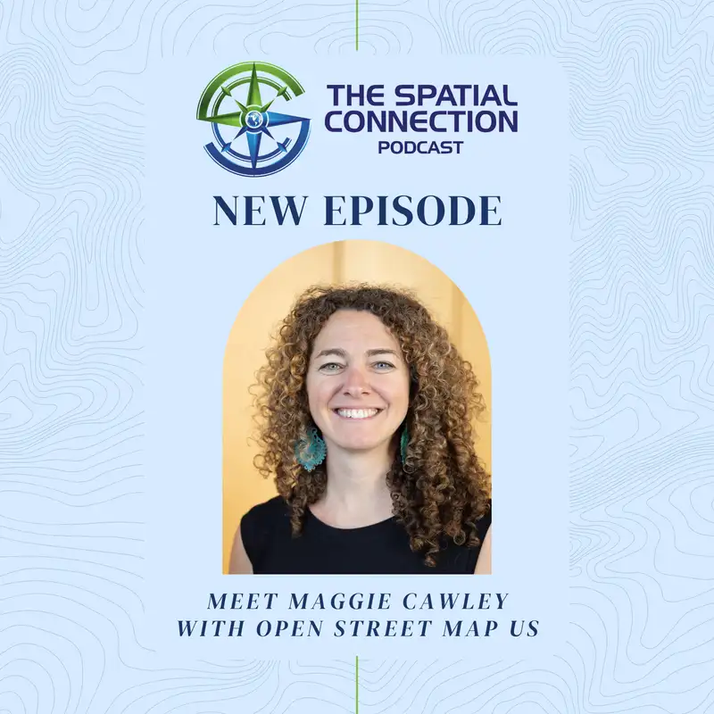
Maggie Cawley
[00:00:00] Kelly: Welcome back to the Spatial Connection, the podcast where we explore the fascinating journeys of geospatial professionals and dive into the incredible ways location-based technologies are shaping our world.
[00:00:10] Kelly: I'm your host, Kelly McGee, and today's guest is Maggie Cawley, the Executive Director of OpenStreetMaps US.
[00:00:17] Kelly: Like many young people, the National Geographic magazine sparked Maggie's interest at an early age to learn about different countries and cultures around the world. That interest has led her on an amazing journey filled with exciting stories and establishing worldwide connections. Join me now as I talk with Maggie to learn about her fascinating journey.
[00:00:38] Kelly: All right. Welcome back to the podcast, everybody. Today, we have Maggie Cawley with us. Maggie, this is one of the episodes I've been kind of looking forward to. You know, you have these programs that you're familiar with a lot of times, and you use them, but you don't get to talk to people behind the scenes, and OpenStreetMap is definitely one of those.
[00:00:59] Kelly: I use it [00:01:00] tremendously. Uh, I know a lot of people within the industry use OpenStreetMaps. A lot of people don't really understand how OpenStreetMaps is set up, how it's designed, who are the people behind it. So today, I hope we get a chance to tell everybody and teach everybody a little bit about this. So welcome to the podcast, and what I'd like to start with is get a little bit of knowledge about you.
[00:01:22] Kelly: So let's start there. How did you learn about GIS, and where did you get your start? Maybe kind of give us an idea of how you, what got you interested in the topic, and maybe h- where you started off in your education career, and then let's work through your career path from there.
[00:01:38] Maggie: Sure. Um, hello, everyone.
[00:01:40] Maggie: Great to be here. Thanks, Kelly, for having me. Let's see. My map journey started a long time ago, so we'll go way back. I loved maps from a, very young age. I, I grew up in the middle of nowhere, Pennsylvania, but thankfully, my father, he subscribed to the National Geographic magazine, and I just loved every time they had [00:02:00] a map, I'd pull it out, hang it on the wall.
[00:02:02] Maggie: Um, and it just really was exciting to learn about new places and see them on a map. We didn't travel a lot as kids, but it just kind of spurred that curiosity about cultures So fast-forward and I end up going to undergrad for international studies. I wanted to be an ambassador. It just seemed like a really cool job, or a travel photographer, but I wanted to go and see the world.
[00:02:26] Maggie: Uh, so I took, you know, Russian art and history of China and all of these courses to learn about the world. I graduated and I, I went to take a job with International YMCA in Germany. Turned out that fell through. I paid the wrong guy. I got scammed.
[00:02:41] Kelly: Oh, no.
[00:02:42] Maggie: He took all my money. Yeah. And I was not going to Germany.
[00:02:47] Maggie: I had taken seven years of German, which everyone was like, "Why are you doing that? That doesn't make any sense." So I found myself out of college with no job and, and kind of a, a left turn, and I, I got hired by a [00:03:00] temp agency and I started doing odd jobs. And my first main job, this group, um, of developers in Richmond hired me.
[00:03:08] Maggie: They were doing a redevelopment project downtown Richmond, and they took me on as a temp, and I ended up working for them for five years. During that time, I kind of got interested in the whole adaptive reuse, redevelopment, and I said, "Would you y'all send me back t- to school? I'd like to, to learn more about this."
[00:03:26] Maggie: So that's when I went back to VCU and, and I started studying urban planning. So it wasn't until my early 20s that I touched my first GIS. Uh, learned SPSS. This was the early 2000s, so it was...
[00:03:39] Kelly: That's not a fun program.
[00:03:41] Maggie: No, it wasn't something that caught my eye, for sure. But I started learning about how to make maps, which would've been really handy back at University of Richmond in my undergrad, you know, learning about-
[00:03:51] Maggie: um, all those places. But that's, that's where I found maps, and I, I ended up doing my thesis there for a county in [00:04:00] Maryland. I did a water resources element for Cecil County, Maryland, uh, as my thesis, and it was a real project, which led me to getting hired on full time for a company called Environmental Resources Management.
[00:04:13] Maggie: So I left the development world and moved to, uh, Maryland and had that job for about five years, and that's where I really dove into GIS.
[00:04:21] Kelly: So did you get to use GIS in that position then, I guess, right?
[00:04:24] Maggie: Well, I, started out doing a lot of field work, so I was out mapping wetlands- Okay ... and, and doing a lot of data collection in the field 'cause I, I just said yes to everything.
[00:04:32] Maggie: I was like, "Oh, sure. I'll go out and carry this machine and put points on the map." And during that time, I went back to school again. I went to Hopkins for a GIS certificate, and I really enjoyed remote sensing and learning, and a lot of what I was doing back then was tracing.
[00:04:47] Kelly: All that good old digitizing.
[00:04:50] Maggie: A lot of digitizing. You know, we had projects for a lot of the ins- extractive industries, so doing environmental impact assessments for, you know, companies like Alcoa, [00:05:00] um- Mm-hmm ... places that didn't have a lot of map data. So I found myself, you know, digging in and, and doing a lot of geo-referencing and, and, and mapping, uh, back then.
[00:05:09] Maggie: And In those five years, I became one of the main mappers for a lot, like two of the offices, the DC office and Maryland. And it really got me thinking, like, what, this mapping thing is really important. Like, why do we keep it in the back rooms? This is a skill that everybody should have.
[00:05:26] Kelly: you start really understanding where maps come from and that they don't just show up.
[00:05:30] Maggie: Yeah. They do. They don't just show up, and there's not just this magic data, at least at the time. Um, now we've got, you know, OSM has matured, so there is some magic data out there for a lot of places. But, um, yeah, at the time it was, it was a lot of map making, a lot of kind of depressing work in a way. You know, doing impact assessments for, for an extractive industry, there's a lot of things that get messed up.
[00:05:55] Maggie: Yes. So mapping those were... It was kind of slowly, my soul was [00:06:00] dying. Totally. Let me just say. So after five years there, it seems to be a trend, um, I decided, you know, I, I don't think I can, can work here anymore. I would really like to get GIS and mapping out of the back room. Like, I think, I think I can do something different.
[00:06:16] Maggie: So I, I left DRM and I started my own company, BoomGeo, and my goal was to bring GIS and data into the hands of a lot of nonprofits and folks who were really making a difference out there and see if I could help them with this really cool tool.
[00:06:31] Kelly: I think that's a very interesting point that you bring up.
[00:06:34] Kelly: A lot of people don't know about GIS because it is that back room technology still. Uh, people see like the final output, a map or what have you, but they don't think about, again, the people that put this together and how that data had to be collected. And so it still becomes that back room technology in a lot of cases.
[00:06:56] Kelly: Uh, I think web technology's helped out by putting it [00:07:00] more in the forefront, but there's still all that data collection. There's, you know, even in this day and age, it's different techniques in a lot of cases, but there's still that digitization of data and-
[00:07:11] Maggie: It is ...
[00:07:12] Kelly: so yeah, that's very interesting to-
[00:07:13] Maggie: Yeah
[00:07:14] Maggie: that, you know, that's a driving force and I, I like the idea. It's like, hey, I gotta, I gotta bring this out. I gotta let more people know about it.
[00:07:20] Maggie: It's not necessarily a money maker, I'll say that. So that was about, that was in 2013. So I had my first, my first job with a group. Um, I was living in Baltimore at the time, and I, I got my first gig, uh, in consulting, and that's when I realized that I needed to learn new software.
[00:07:39] Maggie: My budget did not allow me to invest in the software that I had been using all that time. So, um, I had to, again, kind of start over and, and learn. I learned QGIS and I started, figuring out how to navigate its whole new world of open source. So I went to my first FOSS4G North America conference.[00:08:00]
[00:08:00] Maggie: I met that community, and they really pulled me in. It was, you know, just some of the most wonderful people I had ever met.
[00:08:06] Kelly: Some really smart people.
[00:08:09] Maggie: Yeah. Yeah,
[00:08:09] Maggie: It's amazing. Um- And that's what led me to OpenStreetMap. I started teaching, uh, open source.
[00:08:15] Maggie: Like, I- when my second gig was for a group called Parks and People Foundation in Baltimore, and they have a summer program for the city kids. And I went to their office and I said, "Hey, you know, it's kind of a, a random idea, but what do you think about having a couple days where I come in and I teach the students how to make a map?
[00:08:32] Maggie: You know, we'll go out in the inner harbor and they'll, you know, collect data, and I'll like teach them how to use GPS." And the woman was like, "You know what? That sounds interesting. Let's do it." and I tried it, and the kids were really receptive, and it was so cool to, watch them go out and, take a point and then bring it back and, see it show up on a map.
[00:08:51] Maggie: It was just like this one-to-one connection with geography. And I was like, this is it. This is, this is really cool. So I, you know, over the next seven years I [00:09:00] continued to teach not only students, but, you know, university students. I did a course in Mauritius. I traveled all over and I, I taught people, uh, professionals, and it was kind of a wild ride.
[00:09:12] Kelly: And, you know, I've, having done teaching myself, I think teaching's a great way to learn more. You know, you learn more about whatever it is, the tools that you're using. You get it, 'cause you have to explain it, so learning a little bit more about it as you go along. And there is something about
[00:09:28] Kelly: When you show somebody and, and they get it, you, you see that, that spark in there. Yeah. And it makes it, it's exciting.
[00:09:34] Maggie: It is. And, you know, it's sometimes you d- you don't always succeed. Um, I had a course where I was like, "You know what? I'm gonna teach them how to fly a drone." And I wasn't really a great drone pilot.
[00:09:45] Maggie: So we're all outside and, you know, on the field and I, you know, I get the drone and flying it around, and then I don't know what happened, but it just kind of, I lost it. Yeah. And it flew across the quad, and it landed on one of the school building's roofs. And I was like, [00:10:00] "And that's what you don't do, everyone."
[00:10:03] Maggie: So I had to pause the class, run around, climb onto the top of this building and, and retrieve the drone, and I have since taken that out of any courses that I teach. But- I'm
[00:10:12] Kelly: sure, it was an interesting class, though.
[00:10:18] Maggie: Yes.
[00:10:19] Kelly: So now that you've been doing some, teaching and stuff quite a bit there, what else did you do while you were at BoomGeo?
[00:10:24] Maggie: So that's where I found a group called TeachOSM. I started teaching with another colleague, and I learned there's a group of folks who started this initiative to bring OpenStreetMap into classrooms.
[00:10:34] Maggie: And, that was a lot of where I got experience and e- exposure to open data. And then, you know, a side thing I did was I had a project called Save Sabie that I worked on in South Africa. and we were collecting data about, you know, hippo migration and the water levels in Lake Sabie. So we'd get groups of students come out to the camp, and I teach them how to use GPS and, map things like hippo [00:11:00] tracks and bird sightings.
[00:11:01] Maggie: Um, and then we would take them on A safari through-
[00:11:05] Kelly: Wow ...
[00:11:06] Maggie: a couple different countries. So we were traveling around a lot in, in Southern Africa at the time. So during that, that time in my life, I got to map game reserves. So I was mapping- ... for, like, the Naro San. Um, I did a, a week with- in the Kalahari Desert with the, we call them the Bushmen, the Naro San tribe, mapping their game reserve.
[00:11:25] Maggie: So, you know, all the watering holes, all the camp sites. They hadn't had a map of their site, and I said, "You know-
[00:11:31] Kelly: ...
[00:11:31] Maggie: wouldn't you like a map?" And they're like, "Well, we don't really have any money to pay you." And I was like, "You know, I've been sleeping in a tent for months." "I would love a couple nights in a real bed in your lodge, and maybe a case of beer."
[00:11:42] Maggie: Cold beer. Nice. So my my colleagues and I drove around and made that map for them, and it's still hanging on their, their entry wall. Wow. And that was probably one of my, my most fun adventures, and my friends really appreciated that case of cold Windhoek Lagers.
[00:11:59] Kelly: I bet. [00:12:00] So, so how did you get into that? I mean, how did all that adventure start?
[00:12:04] Kelly: What was... Is it just like, "Yeah, I'm gonna go check this out," or did you see a flyer? How, how did you get to that?
[00:12:10] Maggie: That was kind of, you know, I started BoomGEO, and then I spent about six months in that first phase, and I just had always wanted to travel around the world. So I had been saving over the years, and I just decided to, to do it.
[00:12:23] Maggie: I, you know, had a 600 square foot apartment. I went down to 46 liter backpack- ... and I took off. And I started out the trip in Sodwana Bay, South Africa. I just picked it out of nowhere, honestly. And I, I was like, "You know, I'm gonna learn how to scuba dive." I was a little bit claustrophobic, so I was like, "Let me just do this.
[00:12:40] Maggie: It's a start." And at the time, I was couch surfing because I was trying to make my penny stretch, and it was a thing back in 2015. And I happened to couch surf with this guy named Peter, and he said to me, "You know, when you're finished this scuba course, I'm about to embark on a three-month trip [00:13:00] around 26 national parks around, you know, seven countries in Southern Africa.
[00:13:03] Maggie: Do you wanna come with me?" I'm taking a few other folks. We're gonna make an expedition out of it." And I just said yes.
[00:13:12] Kelly: Let me check my calendar.
[00:13:15] Maggie: It felt like a wild thing to do, but I thought, "You know what? This is kind of a once in a lifetime opportunity." And he had this land on Lake Sebewa. And I said, "Let's start a program."
[00:13:27] Maggie: And, you know, we ended up working together for years, uh, after that doing this, this work.
[00:13:33] Kelly: That's pretty wild.
[00:13:34] Maggie: So it was just kind of-
[00:13:35] Kelly: Literally
[00:13:35] Maggie: wild ... out of the blue. Yeah. I- I'll share a link. I, I used to blog about it, so there's a lot of stories on my blog, maggiemaps.com, and, um, it's one of those things you go back and look at and like, "Did I really do those?"
[00:13:48] Maggie: Like, it feels two lifetimes ago, right? It's only been, you know, about 10 years, but.
[00:13:52] Kelly: Well, like you said, it's, it's an opportunity of a lifetime and, and it gives you lifetime worth of memories and stories to share. That's pretty [00:14:00] awesome. And you got to do GIS.
[00:14:02] Maggie: I got to do GIS. And actually, I always forget this part for some reason.
[00:14:06] Maggie: It was such an... A, a few years later, I, I reached out to George Washington University and I said, "You know, they're big, use a lot of OpenStreetMap in their courses." And I was like, "You know, if y'all wanna go to Botswana, I've got a connection with the Naro San and they have a lodge, and we can take a group of students."
[00:14:21] Maggie: Darn if we didn't. I planned the trip. I brought 10 George Washington University students to Botswana, and we, we did like a whole geography course over there and-
[00:14:30] Kelly: Nice ...
[00:14:31] Maggie: it was, that was, that was one of my highlights. And then of course, the world changed when COVID came along, and haven't been back since, but.
[00:14:40] Kelly: Well, that's really cool. A what a, great story.
[00:14:44] Maggie: It's not the one I thought I was gonna tell, to be honest.
[00:14:46] Kelly: Well, you know, we talk about those things. It's, it's amazing when you look back on your, your career and, and how you get there, and then you, you get to relive some of these stories as you, you retell them.
[00:14:55] Kelly: And I could tell it, it's an exciting story to you there, so.
[00:14:58] Maggie: It is. There's a, there's a [00:15:00] lot in there.
[00:15:00] Kelly: Awesome. So, so you get back. You, are you still teaching at that time through BoomGeo, or?
[00:15:09] Maggie: Uh, yeah, I was, I was kinda taking things as they came. I was, you know, I had a couple of gigs. You know, c- the consulting world can be a little bit of a rollercoaster.
[00:15:16] Maggie: During that time, I had joined the OpenStreetMap US board, so I guess it was around 2016, I ran and I joined as a board member. Our board is voted on by our membership, which is kind of unique, so it's not chosen by the executive director like most nonprofits. So I ran, and I ended up serving on that board for a couple of years and was actually on the board that hired our first executive director.
[00:15:41] Kelly:
[00:15:41] Maggie: So that was kinda serendipitous. But after a few months, that hire didn't work out, and at the time I was still working on BoomGeo. had a contract just finish, and, you know, I kinda raised my hand as a board member and said, this was 2019, and I was like I'm happy to step in as interim executive director, [00:16:00] help us, you know, through this time, and then we can figure out what to do.
[00:16:05] Maggie: So I will caution anyone out there, the interim can often lead to seven years later. So yeah, it ended up being a great fit for me, and I've, I've really enjoyed, you know, learning and, and taking on this role. It was meant to be very short-term at first.
[00:16:20] Kelly: Oh, really? Short-term in the grand scheme is now extending out a little bit, huh?
[00:16:26] Maggie: A little bit.
[00:16:27] Kelly: Well, that's good, though. So-
[00:16:30] Maggie: Yeah ...
[00:16:30] Kelly: now you're the, executive director there, uh, OpenStreetMap. Let's talk a little bit about OpenStreetMaps, if you would. Can you explain to the listeners, you know, of course we have OpenStreetMap, but in, within regards here, you have OpenStreetMaps US.
[00:16:44] Kelly: How is OpenStreetMaps organized?
[00:16:47] Maggie: Sure. Yeah. So the short answer there is it's, it's not really, you know? But, uh, we have, um... So OpenStreetMap, for those of you who are listening and, may not be familiar, free open source, open data [00:17:00] mapping commons of the world. Um, it's mapped, very micro mapped. So you think any bench, any walkway, road, house, tree even, you can map in OpenStreetMap.
[00:17:10] Maggie: And, anyone with an email address can sign up and start mapping their communities. So a lot of people co- reference it as the Wikipedia of maps. And so it started gosh, 22 years ago, 2004, um, in the UK. It was started by a man who wanted to collect data, actually to start a business. So he hired couriers, drive around London and collect data and just load it onto the internet.
[00:17:36] Kelly: Hmm.
[00:17:37] Maggie: Well, this caught on. Then there were map-a-thons and mapping parties, and anyone could upload the data. Within a short time, thought, "You know, this is something I don't think I can manage because I wanna manage my business." So OpenStreetMap Foundation was created to be the steward for the OpenStreetMap database.
[00:17:54] Maggie: You know, in the last 22 years, I think it's grown way beyond Steve Coast's wildest dreams. [00:18:00]
[00:18:00] Kelly: Yeah, it's, it's tremendous how, the breadth of how it's used.
[00:18:04] Maggie: Yeah. So then in 2010, OpenStreetMap US was formed by a group of mapping enthusiasts here in the US. Uh, they wanted to, have a conference. And to collect sponsorship donations, you kind of have to have a 501[c][3].
[00:18:19] Maggie: So this group of folks put together a 501[c][3] application, and OpenStreetMap US was born. Our tenet remains the same. You know, we, we convene all of the folks who touch OpenStreetMap, whether it's academia or government mappers. So we are here to support the community through education, bringing them together, creating spaces to share ideas.
[00:18:42] Maggie: So for the first 18, no, eight, nine years, OpenStreetMap US was still run completely by an all-volunteer board, so just passionate folks willing to put their time in to keeping this afloat. It's pretty inspiring.
[00:18:56] Kelly: Yeah. So you've been doing this, for a while now. So I guess [00:19:00] as your role, what do you, can you kinda give us an idea of what your role is and how you work within the organization, and, and what are some of the things that you try to accomplish?
[00:19:09] Maggie: Sure thing. Yeah. So when I first walked in, it was, it was almost like I was walking into a vacuum, right? Because pre- previously there wasn't really anyone to call. There was no one to complain to or ask questions. There was a big community out there that had a lot of helpful people, but there was no one you could point to, just like, "Ask her."
[00:19:27] Maggie: So I became the ask her, and boy, the- The mistake I made early on was putting our phone number on the website. I mean, I got phone calls, "There's a trail in my backyard." I'm like, "Well, is there a trail in your backyard?" "Yes." "Okay, then it's gonna get mapped." We've since taken the phone number off the site. So initially it was, it was kind of a firestorm, honestly.
[00:19:50] Maggie: It was like, okay, what, what do we do with this? I was the only paid staff. There's only so much I can do. You know, as you're aware, as soon as I stepped in, the world kinda shut [00:20:00] down, and, you know, State of the Map U.S. was our main flagship, it was our main fundraiser. So I was here in a spot thinking, "What do we do now?"
[00:20:10] Maggie: So I focused on building programs. Uh, Teach OSM became a program of OpenStreetMap US. We support tasking managers and technology. So over the last five or so years, we've really leaned into program building, creating working groups to bring people together, education. Um, we're still bringing OpenStreetMap into classrooms around the country, educating high school teachers through that program.
[00:20:35] Maggie: Yeah, so my role now has evolved into more nonprofit management, which is very different than making maps, but, you know, we've got a staff of four, so we're able to do a lot more. and I'm, I'm able to travel and, and kind of do a lot of speaking at conferences and engaging with the rest of the geospatial community so that, they know that we're here for them as well.
[00:20:55] Kelly: Awesome. That's, uh, definitely a full-time job right there. [00:21:00]
[00:21:00] Maggie: Yes. Yes. But you know what? I've really found this, this is kind of a, maybe people will agree, but I just really like mappy people. You know, people who are, are interested in maps tend to be curious. They're interested in the world. They, they generally wanna make it a better place, and, you know, especially meeting a lot of the mappers as part of our community that come to our conference every year, it's like people are out there doing this because they wanna make their community better.
[00:21:27] Maggie: You know, they'll, they'll map the sidewalks, they'll map the crosswalks. They're, they're genuinely mostly great people.
[00:21:34] Kelly: I would suspect, and I, and this is people that I met along my journey as well You have a lot of people, you know, for a long time, the average citizen, their exposure to maps might have been a road atlas.
[00:21:49] Kelly: You know, they were gonna take their vacation or whatever, they would use a road atlas and get from point A to point B. And they just assumed that, you know, some government body or whoever created these maps and had [00:22:00] everything accounted for. Not always the case, and they might update their atlas once every five years.
[00:22:07] Kelly: They might go buy a new one 'cause the other one ripped or they couldn't find it. But, they didn't always realize that a lot of those features change a lot more frequent than every five years. Absolutely. Well, then, then we move up to, like, Google Maps. Everybody starts getting Google Maps on their phones, and Apple Maps, and all these other providers as well.
[00:22:28] Kelly: so now we're, everybody has accustomed to having a map available to them, but they still don't think about how does that data get updated. And then those that are more interested in their community, they tend to say, "Well, that street's wrong," or, "It's missing a street," and that kinda aggravates them.
[00:22:45] Kelly: So those mappers that you run into, those are the people that they see the same thing. They're like, "Well, Google's got it wrong," or, "Apple's got it wrong," or whoever the provider is, and then they get into, "Well, how do I fix that?" And hopefully they all find their way to, "Hey, [00:23:00] I can use OpenStreetMap, and I have a way that I can contribute to this and make it better."
[00:23:05] Kelly: So I think those that- Yeah ... find their, theirselves getting to that point are, as you see, are very excited to, to have that opportunity to contribute to it, so.
[00:23:16] Maggie: Yeah, and, you know, a lot of times it's people's personal interests. One, one of the projects we've been working on for a little while now is our Trail Stewardship Initiative.
[00:23:23] Maggie: So this is kind of a, a story that might resonate with folks. I got a email a couple years ago from a backcountry coordinator in, um, Utah And it started, "Dear OpenStreetMap," which to me is always uh-oh, what's coming? And, you know, it was beginning, you know, early 2020, maybe mid-2020, that summer, you know, our national parks and, and public spaces were seeing a lot more folks, um, because people weren't traveling as much.
[00:23:49] Maggie: You know, we're all kind of living the COVID life, and there's an uptick in visitation. They also coincided with, you know, you're talking about everyone relying on these maps. Well, there's [00:24:00] this inherent trust that, that scares me for a lot of people believing in that blue dot- Yes ... on their phone. And now, you know, they're out using third-party mapping apps to navigate the parks, whether it's, you know, you've got Strava and AllTrails and Gaia and I for- I don't wanna pick one, Onyx, right?
[00:24:16] Maggie: Mm-hmm. Wherever you are, a lot of that data is coming from OpenStreetMap.
[00:24:20] Kelly: Yes.
[00:24:20] Maggie: So this email was, "Hey, you know, we're here at the park, and we're having a hard time keeping people off of social trails and the like, and they're using these apps. And, you know, we've reached out to the app companies, and they point to OpenStreetMap, and they say, 'Well, it's, it's not us.
[00:24:36] Maggie: It's OpenStreetMap's data.'" Which is very convenient- Right ... when things go wrong, right?
[00:24:41] Kelly: Pass the buck.
[00:24:43] Maggie: Yeah. So she's like, "What can you do?" I know at the time I'm like, "Oh, it's just me, and, you know, we've got thousands of mappers in the US, but I'm not really sure. Would you like to come to one of our mappy hours?
[00:24:55] Maggie: This is something we do periodically. We have virtual mappy hours, and we have a topic [00:25:00] and a speaker, and it's, it's a really fun way to get people together." And thankfully she agreed to come and speak. So we recorded it. I got a- as many people as I could in the outdoor world to come to the talk, and at the end, you know, she presented the problem.
[00:25:14] Maggie: You know, a lot of times t- it's the cartography, so like a map that, a trail that may not have any data is still showing up bold as, like, a place to go within the app or... So at the end of the, the mappy hour, I said, "You know, who would be interested in starting a working group to work on this together? This is a problem that's gonna require, land managers.
[00:25:32] Maggie: It's gonna require app companies. It's gonna require mappers." And darn if everyone just didn't say yes.
[00:25:38] Kelly: Oh, wow.
[00:25:39] Maggie: So we've had that working group in place since then working on this together to address these issues and improve map data in OpenStreetMap, get the word out to folks. I'm hoping to launch a digital trail ambassador program later this year if we can get it together to get more folks who are, interested in hiking and to think about where am I and what is this blue [00:26:00] dot and can I trust it, and how can I fix it.
[00:26:02] Maggie: You know, getting them back to that being part of the map instead of just a user.
[00:26:06] Kelly: I think that is a very important task to do there because of the fact that, I don't know if you run into this or if you experience it any time, but I think people, see something that comes from a big company like Google, Apple, and then they have another organization, OpenStreetMap, and they're not familiar with it.
[00:26:25] Kelly: There's that level of inherent trust because they don't know, this organization. And I find myself a lot of times when I talk to a lot of my clients then I explain how OpenStreetMap works, and I'm like, "This is the way to go because you're gonna have a way to, to curate that data to make sure it, it's correct in your community."
[00:26:44] Kelly: Once they understand that, the changes, they're, they're like, "Wait, this is better than what I could get out of Google or Apple." So, do you run into that a lot where you have to combat the stigma of, OpenStreetMap being this unknown and this [00:27:00] trustworthiness?
[00:27:00] Kelly: Fortunately, that has declined over the years.
[00:27:03] Kelly: Good. Um, OpenStreetMap has matured a lot, but it is still one of the main questions that I get, and, you know, my main message there is always place is personal. You know, there's a, lot of people that care about the data where they live and, you know, we all keep an eye on it. And it's, it's become to a place that, yeah, maybe the tree might be in the exact, exact correct spot, but you're not gonna be using this data for surveying anyway, you know?
[00:27:27] Kelly: So it's, it's really... We have a government working group, and I, in the first two, three years of that, I think almost every other meeting we talked about authoritative data and, that has shifted to fit for purpose. And there's even more and more local governments relying on OpenStreetMap in their day-to-day.
[00:27:46] Kelly: We have a group, there's a talk about it on, on our talk list from State of the Map US last year, Kendall County, Illinois.
[00:27:52] Kelly: I know them.
[00:27:53] Maggie: They've started maintaining their data right in OpenStreetMap for their sidewalks, their addresses, and they have taken kind of ownership in [00:28:00] their area to be that steward of the data in OpenStreetMap And it's saving them probably a lot of time and duplication of efforts, and they've had really success there.
[00:28:10] Maggie: And, if new people come in and map, They welcome them in and, and, if there's any problems there, it's, it's really easy to communicate with other mappers. Our tools make it really nice to be able to say, "Hey," like, "welcome to the community. I don't know if you meant to do this, but hey, this is how you can fix this map."
[00:28:25] Maggie: Or a lot of mistakes that are made are by new mappers. I mean, I know that firsthand from teaching it. You know, they accidentally name a building Mom's House.
[00:28:35] Kelly: Well, it was.
[00:28:36] Maggie: Maybe you don't wanna put... That's always been a funny one, but that's, you know, something that defaults too, and people get better at mapping.
[00:28:45] Maggie: And we're, we're working on building a classroom, so an offline sandbox for folks to learn in so that when they are in that learning stage or if it's a high school class, th- they have that safe space to learn before they start editing in the main map. So hopefully that's something that we'll get [00:29:00] off the ground in the next year or so as well to support that learning.
[00:29:03] Kelly: That's a really good idea, and I think that'll allow people to gain the confidence to do more. That's really good.
[00:29:10] Maggie: Yeah. A lot... You know, when people encounter a new technology, they're like, "I wanna break it."
[00:29:14] Kelly: Right.
[00:29:14] Maggie: Or, you know, they're just... At any age.
[00:29:17] Kelly: Exactly. I'm afraid I'm gonna be the one person in the world that's gonna mess it up.
[00:29:22] Maggie: Right.
[00:29:23] Kelly: So that actually also kinda leads us to one of the questions I encounter a lot, and I'm sure you encounter way more than I do, is when people say, "Okay. Well, if anybody can go update data on this map and create features and, you know, change them, how do you keep it authoritative? How do you keep...
[00:29:40] Kelly: How do you secure that somebody's not doing something malicious?" How would, how would you answer that? Hope you got a better answer than I came up with.
[00:29:47] Maggie: I would like to hear what you say, but I'll, I'll tell you what I'd say. So, you know, the tools have gotten really good, so I think there's, you know, within our ID editor, there's a lot of presets.
[00:29:57] Maggie: It can be really hard to add things. [00:30:00] A lot of the big tech companies rely on OpenStreetMap, and they have their internal quality control folks. We have a, a tool called osm2pga, and that's pretty... Uh, we, we maintain that as a nonprofit. And with that tool, you can actually set up scans to say, "Did anything change in this part of the map?"
[00:30:17] Maggie: and have it sent to you if anything does. So it's easier to monitor now, 'cause the tooling just makes it fairly straightforward to know when things change. And we also have a data working group at the international level, and they keep an eye on things. And, oftentimes it's really easy to tell when, when there is conflict within the map, so if there's change that's keep popping up in the same place or if there's reversions of data.
[00:30:39] Maggie: So those are things that they can flag. There's also a naughty word list that is used to scan. Um, so there's... The technology has evolved as well to, alongside the community, to really make sure that that, those malicious things are, are kept at a minimum.
[00:30:55] Kelly: So, you know, that's really good to hear from you that there are [00:31:00] mechanisms on how to control, what people put out there, there is some level of checking.
[00:31:06] Kelly: Uh, that is one of the things how I explain it to a lot of people is, like you had mentioned before, place is personal. And people that are taking care of their community, they're watching. If they see a change that, that is incorrect, they'll probably just go back and re-change it anyway. They'll keep it up to date.
[00:31:22] Kelly: And I think that's one of the beauties of the whole process is the people putting in the data, they're invested. They have a personal investment into this, and that makes it a lot more trustworthy. They know what the local names are. It's not just what was passed down. We, struggle in our communities around here within the county, there's sometimes the county has the incorrect name on the street.
[00:31:46] Kelly: And they're like, "Well, that's what we use for 911." And the city's like, "Yeah, but that's not the name of the street, it's this." And so we actually can go out there and change that. There are streets that have been planned and there are streets that are no longer there, they've been abandoned. And [00:32:00] sometimes it takes time for those changes to occur in a map, even if it shows up in Google, Apple, whatever, these other third-party applications that may not be using something like OpenStreetMap, but it, you know, it will filter through, but now we can actually make that happen quicker.
[00:32:17] Kelly:
[00:32:17] Maggie: Well, and with our tagging schema, you can add two different names to a road. You can have an honorary name. You can, you, we can figure it out how to, to add those attributes so that it's not just one thing, which is, is kind of a, a nice thing to have. You can, you know, you know, especially different languages.
[00:32:32] Maggie: I mean, OpenStreetMap's available to the native language wherever anyone is.
[00:32:36] Kelly: Also just goes to show about OpenStreetMap, it's not just a base map so much. It is a, a rich data source for people to utilize.
[00:32:45] Maggie: Yeah. Yeah. Be careful going to the wiki. It is a deep dive. You know, you pick, you pick highway equals path, and you could, you could be in there for hours looking at pictures of how to map a trail and what surface type and what's the width, and what is a highway really.
[00:32:58] Kelly: Right. It, trying [00:33:00] to come up with those common terms for a community is one thing. Trying to do that internationally I think has gotta be a big challenge. I'm sure that's something that's always constantly maybe being reviewed and, you know, some new feature comes up.
[00:33:13] Kelly: How do we, how do we tag this? How do we, you know, what attributes do we have to put in here? I think a lot of people don't understand that OpenStreetMap isn't just something you use as your base map. You can actually use the data to support your, your organization. Like you were mentioning Kendall County, which I, I find very interesting because I know these people and they're just north of us here.
[00:33:32] Kelly: So-
[00:33:33] Maggie: Nice ...
[00:33:33] Kelly: that is, you know, is not just a base map. It's a rich data source that is very important, I think, to a lot of people. And I think more and more- Yeah ... local governments, as you mentioned, should utilize that. And it becomes a, it will help the overall content of the data because now you have that personal, context for all these counties and cities and such.
[00:33:56] Maggie: Yeah. No, I find it interest- especially, you know, if, if you're, say you're using QGIS [00:34:00] or, or ArcGIS, you know, you can pull OpenStreetMap up as a base map, and I've seen maps on certain municipalities' websites, say they're showing their trails, that have their trails there over an OpenStreetMap base map.
[00:34:13] Maggie: And it, you can see the difference between the two. And I'm like, "By the way, like, you can go in and change the base map to match this data that you have on top." And I always find that kind of fun to be like, "You're using the base map, but you can use it even more. You know, there's, there's more there for you to, to work on."
[00:34:31] Maggie: And it, it's empowering. You know? It, you can-
[00:34:33] Kelly: It is. And, you know, I, so I, I see the, the use of OpenStreetMap becoming more and more prevalent as people learn about it, and I think that's one of the things that your outreach work Teach OSM will help drive that even further the more people that learn about it.
[00:34:50] Kelly: Especially the young students, those that are in high school getting ready. They may have not started their career in the geospatial industry or a related industry. If they start learning [00:35:00] about this now, they will be able to be contributors along the way. So getting in there early, I think-
[00:35:05] Maggie: Yeah.
[00:35:05] Maggie: And you know, we don't have a... Sorry. We don't have a huge marketing team or anything, so it really is word of mouth. And a lot of the apps will, will have a little tiny I in the corner. Even if you look at the weather channel, I mean, or booking.com, OpenStreetMap is on there, but a lot of times it's hard to tell 'cause the attribution isn't that clear or what.
[00:35:23] Maggie: But if you start looking, OSM in the wild is a fun game to play. To see where you see one.
[00:35:29] Kelly: Well, well, I think it's, it's definitely a valuable data source, That kinda takes us to where are the key projects, you know, and you kinda giving us an idea of what some of the projects are that you work on, especially for driving and promoting OpenStreetMaps if within the US
[00:35:44] Kelly: do you have, like, any big initiative? Where do you see the, the near future for OSM?
[00:35:50] Maggie: Gosh. Well, you know, we are a small nonprofit. We're four folks, and it's been kind of a, a rocky year. You know, thinking we-- A lot of the work [00:36:00] that I do is maintaining our, our fundraising and, and kind of engagement with partners and, um, the environment hasn't been that great lately.
[00:36:07] Maggie: So it, you know, for us, the year ahead looks a lot like fortification. We manage a lot of different tools for the community, OSM Cha, Map Roulette, Tasking Manager, and our TeachOSM projects. So We really wanna work on making sure everything's sustainable despite of different environments or, or things that change in the world.
[00:36:26] Maggie: We are having our conference in Madison this year, so we, we, we change locations. We, we choose a different state every year to bring our State of the Map U.S. to. Um, so that's a big thing we're gonna focus on this year is, is getting as many folks as we can together in Madison in June. And, you know, that's where, where it really gets exciting.
[00:36:44] Maggie: I mean, last year we had over 100 people apply to speak at the conference. Which means that's a hu- more than 100 people who have a different story to tell about how they contribute or how they use OpenStreetMap data, and it's always, it's always pretty amazing. And I sit on the [00:37:00] program committee, and I try to get as many people as I can in the door, so I'm like, "Would you do a five-minute talk?"
[00:37:04] Maggie: So I think we had, um, 86 people speak at the conference in Boston in, last year, and all those talks are available on our site, going all the way back to the first one. And it really gives you an insight into, to the folks that, that show up and are interested in this and don't wanna sit here and plug. But if you haven't been to a State of the Map U.S.
[00:37:21] Maggie: conference, it's, it's very different view into a world that is adjacent to and part of the geospatial community, but it's a different vibe.
[00:37:30] Kelly: I agree. I like the fact that you do move it around. It gives an opportunity for people that don't have the ability maybe to travel a lot, you know, further distance, timeframe, or whatever.
[00:37:39] Kelly: Uh, and it also changes the venue up, so it's always different. It's always changing the where you go, and you get a different group of people showing up.
[00:37:46] Maggie: Yeah.
[00:37:47] Kelly: You know?
[00:37:47] Maggie: Yeah, it got the local flavor.
[00:37:48] Kelly: It does. And I, I think that any of our listeners, if you haven't been to one of these conferences, I highly recommend it.
[00:37:54] Kelly: It's a great place. I think that, in conferences in general, we kinda lost some of that [00:38:00] c- during COVID, you know? And people, it was a while before people started getting back to going to conferences. And-
[00:38:06] Maggie: Yeah ...
[00:38:07] Kelly: you know, I think that conferences are not just a getaway. They're a place to go and talk with those like-minded professionals in your career industry.
[00:38:16] Kelly: And just to get the ideas. You know, I've been to a lot of conferences in my career, and some of them you get there and it, you know, isn't better than others, but almost every one of them you get to meet people and you might hear a unique way that they're using technology and
[00:38:32] Kelly: If you don't know how to get those answers, now you can actually get those because you're running into people that's like, "Oh, hey, I've, I've had that same situation, and here's how I accomplished it." So it, it gives you a new resource, and you get a lot of ideas.
[00:38:46] Maggie: Yeah, and you- so many different perspectives.
[00:38:48] Maggie: I mean, we have a, a teenage mapper that presents every year for the last couple years and, you know, he's up there presenting about his experience as a 15-year-old mapping In front of, you know, the head of the National [00:39:00] Park Service or, you know, the, the DOT, and it, it's, you know, when are you gonna have that opportunity to bring these two worlds together?
[00:39:06] Maggie: And it's always, it's always cool to see what comes out of it and what partnerships are born and-
[00:39:12] Kelly: I think it goes to show that, you don't have to be that seasoned professional. You can be anybody that has an interest into this technology. So maybe you could tell us a little more about how - you found him and how he got started.
[00:39:23] Kelly: I, think that's a good story for the listeners.
[00:39:25] Maggie: Absolutely. Yeah, I mean, it really shows how OpenStreetMap is kind of an on-ramp to the rest of the geospatial world. So every year we do a call for proposals for our State of the Map U.S. conference. Anyone can apply to talk, and I think I mentioned last year we had over 100.
[00:39:40] Maggie: So at Salt Lake City, we had a conference a couple years ago, and we had a application from this 15-year-old mapper, out of Wyoming. And like, you know, this ... We really should give this kid, this guy a chance. You know, let's, let's get him up there. And so his, his talk then was a teenage mapper, and he followed a panel of [00:40:00] folks from the Forest Service and the Park Service talking about data and trails.
[00:40:03] Maggie: You know, he was nervous, but it was one of the best talks I saw all day. He did a really great job, and then came back last year, came back to Boston, and his talk last year was fixing data that's as old as me. So that got a lot of laughs and, again, he just re- really did a great job presenting, and his father was there with him, and so, you know, Liam looks forward to this every single year.
[00:40:25] Maggie: And, you know, he's found a community that he feels welcome in, and, who knows where this will lead him on his career path. But, it's one of the reasons I'm so passionate about the education side and, really bringing GIS out of that back room, and I think I've found my on-ramp. You know, OpenStreetMap creates that one-to-one scale, and it, it teaches folks, how to connect with that blue dot and, and really that they're connected to the data that they use every day.
[00:40:50] Kelly: Yeah, I think that is very interesting because of the fact that it shows like you were saying, it shows that path how do you get involved? And the fact that he took the steps to do that, that's [00:41:00] amazing.
[00:41:00] Maggie: When it's less intimidating than a giant GIS software where you're, like, learning how to code in Python.
[00:41:06] Maggie: You know, you'll get there, but you don't have to start there, right? You can, you dip your toe in.
[00:41:10] Kelly: and the work that he's doing, it's contributing to more than just him and then the community. So the community expands.
[00:41:17] Maggie: Absolutely.
[00:41:18] Kelly: That's an, it's an awesome one. So, at the next conference, I hope I get a chance to meet this young man,
[00:41:23] Maggie: Yeah. Yeah, I hope he shows up. We still have our call for proposals open, and, you know, everyone waits to the last minute to submit,
[00:41:28] Kelly: So, you know, we, we talked about, I think a little bit about how things are coming back. Do you have... You know, we've got the, the State of the Map Conference.
[00:41:37] Kelly: Are there other events that you attend, and where else can people learn more about OpenStreetMap?
[00:41:43] Maggie: Sure thing. Yeah. I'm, I'm gonna be going up to Wisconsin here soon for the Wisconsin GIS Conference. I help throw a FedGeo Day, which happens every year in DC. I'll likely be speaking there. we have our Mapping USA Conference this weekend.
[00:41:57] Maggie: It probably won't make it in time, but we do a virtual [00:42:00] conference every year for OpenStreetMap, US, which really brings a lot of people from across the country. but I, I travel around. I, like to, to meet folks, try to hit nine or 10 conferences a year- Wow ... which is quite a lot, but always happy to do any kind of virtual meeting or, or talk to get folks engaged and, and help people learn more about OpenStreetMap.
[00:42:23] Kelly: That's awesome. And, I think it's one of those things that more and more people, as they learn, you're gonna have, the community is gonna grow and you're probably gonna be getting a little bit more busy because the fact that you'll have to go talk to more people.
[00:42:37] Maggie: Absolutely. It is, it's a good problem to have, right?
[00:42:40] Maggie: That we wanna bring everyone in and, I mean, there's more than eight million folks who have already touched OpenStreetMap over the, over the lifetime of the project-
[00:42:46] Kelly: Wow ...
[00:42:47] Maggie: all over the world, and you could probably go to any city and find a mapper, which is pretty nice. There's an international conference every year, I think we're gonna go this fall.
[00:42:55] Maggie: It's gonna be in Paris, and that will bring mappers from all over the world to talk [00:43:00] about, what we can do together to make the project even better.
[00:43:02] Kelly: Yeah. I know there's a lot of topics on here that I could probably talk for another couple hours. I got a lot more questions to ask for you, but we'll try not to overdo it here.
[00:43:10] Maggie: Yeah.
[00:43:11] Kelly: I think that what I'd like to, to end with is give you a chance to, use this conversation here to reach out to an audience a little bit more, is for people trying to get involved- What is the best way for them to get involved? Where should they go?
[00:43:27] Kelly: You know, what, what should they do if they want to be contributors?
[00:43:30] Maggie: Absolutely. Yeah. So there's a lot of, uh, learning materials out there, but I think one of the, the most fun things is getting to know those other folks, those usernames and, and the people behind it. So I would encourage folks to look at our list of working groups.
[00:43:43] Maggie: Maybe something grabs your attention. We have a pedestrian working group, a government. We have a collaborator sync, which brings together companies that are using OpenStreetMap. and I think one of the things that people need to be reminded of, even if you're just a user of the base map, you're still a part of the community, [00:44:00] so we really wanna create that two-way street and, you know, join OpenStreetMap as a member.
[00:44:04] Maggie: you get our newsletter. There's ... It's what? 20 bucks a year, um- Okay ... to, to be a part of our, our membership. Join the conference. There's, there's a lot of talks online. If you wanna get started watching some of those presentations from the past State of the Map U.S. conferences is a really great way to, to think about the map in a different way, 'cause like I said, there's a myriad, you know, over 80 different uses just last year.
[00:44:28] Maggie: So those stories can be really inspiring, and that might lead you to, to learning how to, to use the data or, or to map certain features or getting involved in a way that you may not thought you were interested in.
[00:44:40] Kelly: Very cool. Well, I encourage other people to go out there and get involved as well. So I hope we, we see more people out of this.
[00:44:48] Kelly: Like I said, I know if I sat down in here, I could talk to you for hours. I'm sure you've got a lot more interesting stories to tell us.
[00:44:55] Maggie: If there's a Spatial Connection happy hour.
[00:44:58] Kelly: There you go. so [00:45:00] with that, I'm gonna wrap it up for our listeners here. I do appreciate you being on the podcast here.
[00:45:04] Kelly: I think this is gonna be a good episode for people. I know I've enjoyed talking with you. I've learned a lot. I know I wanna get more involved with it just because, I, I'm hearing these opportunities, and even though as I think a lot of people are in a similar boat. We may use Open Street Map, but you don't always think about how you can contribute to it.
[00:45:23] Kelly: And I think that more of us users need to also become contributors, and I think that would be a, a benefit not just to us, but to everybody.
[00:45:32] Maggie: Absolutely. The rising tide lifts all the boats, so everyone's welcome. Thank you, Kelly, for, for giving me this opportunity to, to share my story and some stories I didn't expect to share.
[00:45:44] Kelly: Well, I'm glad you did. They were very interesting. so.
[00:45:47] Maggie: Excellent.
[00:45:47] Kelly: with that, I'm gonna stop asking you questions right now, But again, I do appreciate you being on here.
[00:45:52] Maggie: Thank you very much and-
[00:45:53] Maggie: hope to talk to you soon.
[00:45:54] Kelly: Same here. All right, we'll talk to you later.
[00:45:56] Maggie: All right.
[00:45:57] Kelly: Thank
[00:45:57] Maggie: you. Thanks.
[00:45:58] Kelly: Thanks for joining us on the Spatial [00:46:00] Connection. If you enjoyed today's episode, please don't forget to subscribe, rate, and review the podcast on your favorite platform. You can also follow us on social media and our website.
[00:46:09] Kelly: Do you know someone with a fascinating geospatial story? If so, send us a message. We'd love to hear about them. Until next time, stay curious, stay connected, and keep exploring the world through the lens of geospatial technology.
Creators and Guests